 Old Cumbria Gazetteer
 |
 |
|
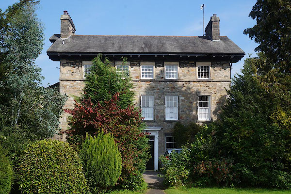
| Rectory, Kirkby Lonsdale | ||
| Rectory | ||
| Street:- | Vicarage Lane | |
| locality:- | Kirkby Lonsdale | |
| civil parish:- | Kirkby Lonsdale (formerly Westmorland) | |
| county:- | Cumbria | |
| locality type:- | buildings | |
| coordinates:- | SD61077889 | |
| 1Km square:- | SD6178 | |
| 10Km square:- | SD67 | |
| references:- | Listed Buildings 2010 |
|
|
|
||
 CBO29.jpg (taken 5.9.2014) |
||
|
|
||
| evidence:- | old map:- OS County Series (Wmd 47 8) placename:- Vicarage, The |
|
| source data:- | Maps, County Series maps of Great Britain, scales 6 and 25
inches to 1 mile, published by the Ordnance Survey, Southampton,
Hampshire, from about 1863 to 1948. |
|
|
|
||
| evidence:- | database:- Listed Buildings 2010 placename:- Rectory placename:- St Mary's Lodge |
|
| source data:- | courtesy of English Heritage "RECTORY AND ST MARY'S LODGE / / VICARAGE LANE / KIRKBY LONSDALE / SOUTH LAKELAND / CUMBRIA / II / 75271 / SD6107678895" |
|
|
|
||
 Lakes Guides menu.