 Old Cumbria Gazetteer
 |
 |
|
| pinfold, Carlisle (2) | ||
| City Pound | ||
| civil parish:- | Carlisle (formerly Cumberland) | |
| county:- | Cumbria | |
| locality type:- | pinfold | |
| coordinates:- | NY40105653 (estimate) | |
| 1Km square:- | NY4056 | |
| 10Km square:- | NY45 | |
| references:- | Howard 1790s |
|
|
|
||
| evidence:- | old map:- Howard 1790s (town-Crls) |
|
| source data:- | Town plan, uncoloured engraving, Plan of the City of Carlisle
and Places Adjacent, Cumberland, scale about 19 inches to 1
mile, probably by J Howard, 1793 and engraved by James Lowes,
published by Francis Jollie and Sons, Carlisle, Cumberland, 1811.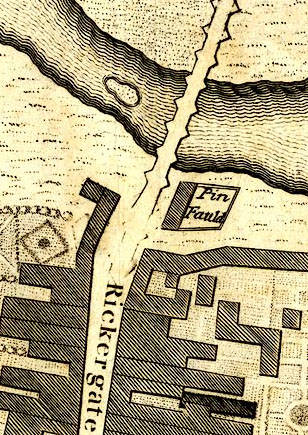 JL08Pce1.jpg "Pin Fauld" item:- Armitt Library : A214.1 Image © see bottom of page |
|
|
|
||
 Lakes Guides menu.