 Old Cumbria Gazetteer
 |
 |
|
| Middle Bridge, Hesket | ||
| Middle Bridge | ||
| site name:- | Petteril, River | |
| locality:- | Brockleymoor | |
| locality:- | Plumpton | |
| civil parish:- | Hesket (formerly Cumberland) | |
| county:- | Cumbria | |
| locality type:- | bridge | |
| coordinates:- | NY48953689 | |
| 1Km square:- | NY4836 | |
| 10Km square:- | NY43 | |
| references:- | Listed Buildings 2010 |
|
|
|
||
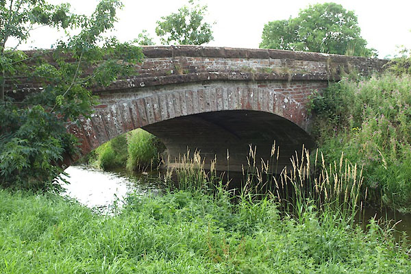 BYX92.jpg (taken 2.8.2013) 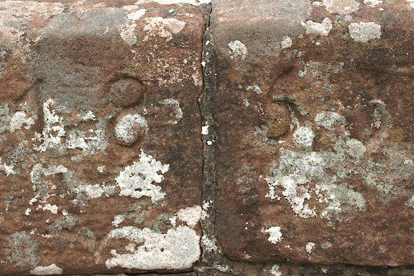 BYX94.jpg Date:- "1866" (taken 2.8.2013) |
||
|
|
||
| evidence:- | old map:- Donald 1774 (Cmd) |
|
| source data:- | Map, hand coloured engraving, 3x2 sheets, The County of Cumberland, scale about 1
inch to 1 mile, by Thomas Donald, engraved and published by Joseph Hodskinson, 29
Arundel Street, Strand, London, 1774.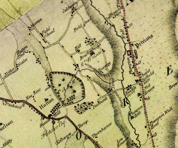 D4NY43NE.jpg double line across a river; a bridge at Brocklemoor item:- Carlisle Library : Map 2 Image © Carlisle Library |
|
|
|
||
| evidence:- | old map:- Bell 1892 placename:- Plumpton Middle Bridge |
|
| source data:- | Map, colour lithograph, Road Map of Cumberland, by George Joseph
Bell, scale about 2.5 miles to 1 inch, printed by Charles
Thurnam and Sons, Carlisle, Cumberland, 1892.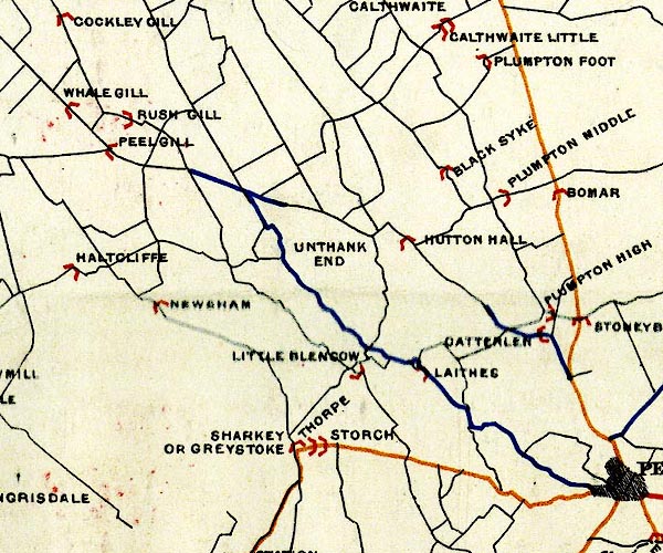 BEL9NY43.jpg "PLUMPTON MIDDLE" bridge symbol Road map of Cumberland showing County Bridges item:- Carlisle Library : Map 38 Image © Carlisle Library |
|
|
|
||
| evidence:- | database:- Listed Buildings 2010 placename:- Middle Bridge |
|
| source data:- | courtesy of English Heritage "MIDDLE BRIDGE / / / HESKET / EDEN / CUMBRIA / II / 73878 / NY4895136891" |
|
| source data:- | courtesy of English Heritage "Roadbridge. Dated 1855 on parapet. Red sandstone. Single segmental arch and small overflow channel. Rusticated voussoirs under string course and solid parapets. Overflow channel has 2 vaulted passages." |
|
|
|
||
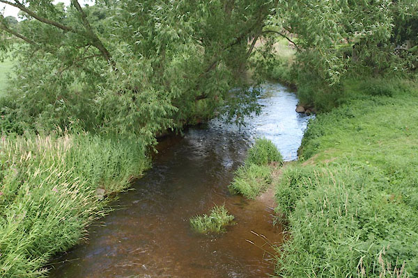 BYX95.jpg View of river. (taken 2.8.2013) |
||
|
|
||
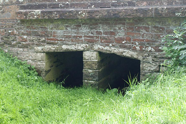 BYX93.jpg Overflow chennel. (taken 2.8.2013) |
||
|
|
||
 Lakes Guides menu.