 Old Cumbria Gazetteer
 |
 |
|
| Lowgill Station, Lowgill (2) | ||
| Lowgill Station | ||
| site name:- | Lancaster and Carlisle Railway | |
| locality:- | Lowgill | |
| locality:- | Dillicar | |
| civil parish:- | Grayrigg (formerly Westmorland) | |
| county:- | Cumbria | |
| locality type:- | railway station | |
| coordinates:- | SD61669681 (about) | |
| 1Km square:- | SD6196 | |
| 10Km square:- | SD69 | |
| SummaryText:- | 1st Lowgill Station, opened with the railway, 1846; closed 1861. | |
|
|
||
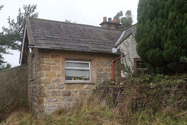 CEK83.jpg (taken 4.12.2015) |
||
|
|
||
| evidence:- | old map:- OS County Series (Wmd 34 12) |
|
| source data:- | Maps, County Series maps of Great Britain, scales 6 and 25
inches to 1 mile, published by the Ordnance Survey, Southampton,
Hampshire, from about 1863 to 1948.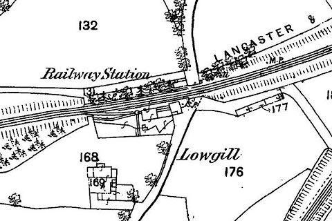 click to enlarge click to enlargeCSRY0175.jpg "Railway Station / S.P. / M.P." |
|
|
|
||
| evidence:- | possibly old map:- Garnett 1850s-60s H placename:- Low Gill Station |
|
| source data:- | Map of the English Lakes, in Cumberland, Westmorland and
Lancashire, scale about 3.5 miles to 1 inch, published by John
Garnett, Windermere, Westmorland, 1850s-60s.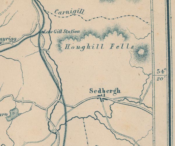 GAR2SD69.jpg "Low Gill Station" dot by railway item:- JandMN : 82.1 Image © see bottom of page |
|
|
|
||
 Lakes Guides menu.