 Old Cumbria Gazetteer
 |
 |
|
| Low Brookside, Ireleth | ||
| Low Brookside | ||
| Street:- | Saves Lane | |
| locality:- | Ireleth | |
| civil parish:- | Askam and Ireleth (formerly Lancashire) | |
| county:- | Cumbria | |
| locality type:- | buildings | |
| coordinates:- | SD22197776 | |
| 1Km square:- | SD2277 | |
| 10Km square:- | SD27 | |
| references:- | Listed Buildings 2010 |
|
|
|
||
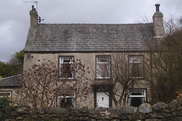 CCS10.jpg (taken 27.3.2015) 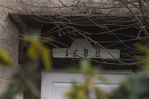 CCS11.jpg Date stone:- "1688" (taken 27.3.2015) |
||
|
|
||
| evidence:- | database:- Listed Buildings 2010 placename:- Low Brookside item:- date stone (1688) |
|
| source data:- | courtesy of English Heritage "LOW BROOKSIDE / / SAVES LANE / ASKAM AND IRELETH / BARROW IN FURNESS / CUMBRIA / II / 388590 / SD2219077760" |
|
|
|
||
 Lakes Guides menu.