 Old Cumbria Gazetteer
 |
 |
|
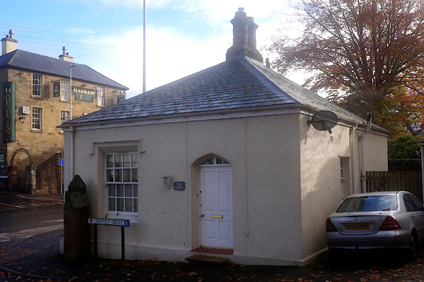
| Lodge, Harraby | ||
| site name:- | road, Penrith to Carlisle | |
| Street:- | London Road | |
| locality:- | Harraby | |
| civil parish:- | Carlisle (formerly Cumberland) | |
| county:- | Cumbria | |
| locality type:- | buildings | |
| locality type:- | toll house (ex) | |
| locality type:- | toll gate (site) | |
| coordinates:- | NY41585434 | |
| 1Km square:- | NY4154 | |
| 10Km square:- | NY45 | |
| references:- | Listed Buildings 2010 |
|
|
|
||
 CFQ33.jpg (taken 4.11.2016) |
||
|
|
||
| evidence:- | old map:- OS County Series (Cmd 23 8) |
|
| source data:- | Maps, County Series maps of Great Britain, scales 6 and 25
inches to 1 mile, published by the Ordnance Survey, Southampton,
Hampshire, from about 1863 to 1948. "T.P." gate across road, building |
|
|
|
||
| evidence:- | database:- Listed Buildings 2010 placename:- Lodge, The placename:- Harraby Toll Gate |
|
| source data:- | courtesy of English Heritage "THE LODGE / 258 / LONDON ROAD / CARLISLE / CARLISLE / CUMBRIA / II / 386784 / NY4150054441" |
|
|
|
||
 Lakes Guides menu.