 Old Cumbria Gazetteer
 |
 |
|
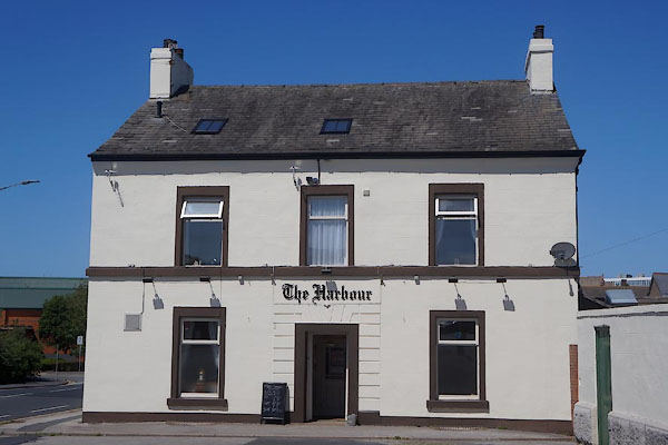
| Harbour Hotel, Barrow-in-Furness | ||
| Harbour Hotel | ||
| Street:- | Strand | |
| locality:- | Barrow-in-Furness | |
| civil parish:- | Barrow-in-Furness (formerly Lancashire) | |
| county:- | Cumbria | |
| locality type:- | inn | |
| coordinates:- | SD20186873 | |
| 1Km square:- | SD2068 | |
| 10Km square:- | SD26 | |
| references:- | Listed Buildings 2010 |
|
|
|
||
 CDG50.jpg (taken 7.6.2015) |
||
|
|
||
| evidence:- | old map:- OS County Series (Lan 21 12) placename:- Harbour Hotel |
|
| source data:- | Maps, County Series maps of Great Britain, scales 6 and 25
inches to 1 mile, published by the Ordnance Survey, Southampton,
Hampshire, from about 1863 to 1948. |
|
|
|
||
| evidence:- | database:- Listed Buildings 2010 placename:- Harbour Hotel |
|
| source data:- | courtesy of English Heritage "HARBOUR HOTEL / / STRAND / BARROW IN FURNESS / BARROW IN FURNESS / CUMBRIA / II / 388607 / SD2018568735" |
|
|
|
||
 Lakes Guides menu.