 |
 |
   |
|
|
|
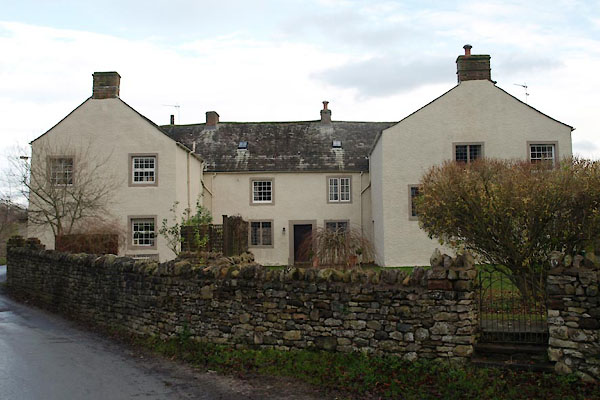
Hall Farm |
| locality:- |
Morland |
| civil parish:- |
Morland (formerly Westmorland) |
| county:- |
Cumbria |
| locality type:- |
buildings |
| coordinates:- |
NY59982247 |
| 1Km square:- |
NY5922 |
| 10Km square:- |
NY52 |
| references:- |
Listed Buildings 2010
|
|
|
|

BVT10.jpg (taken 2.12.2011)
|
|
|
| evidence:- |
old map:- OS County Series (Wmd 8 11)
placename:- Hall
|
| source data:- |
Maps, County Series maps of Great Britain, scales 6 and 25
inches to 1 mile, published by the Ordnance Survey, Southampton,
Hampshire, from about 1863 to 1948.
|
|
|
| evidence:- |
database:- Listed Buildings 2010
placename:- Hall Farm
|
| source data:- |
courtesy of English Heritage
"HALL FARM; HOUSE AND ADJOINING COTTAGE / / / MORLAND / EDEN / CUMBRIA / II / 423197
/ NY5998922477"
|
|
|
| evidence:- |
database:- Listed Buildings 2010
item:- date stone (1709)
|
| source data:- |
courtesy of English Heritage
"ENTRANCE ARCH, THRESHING BARN, BYRES, AND GIN GANG TO NORTH EAST OF HOUSE AT HALL
FARM / / / MORLAND / EDEN / CUMBRIA / II / 423198 / NY6002422499"
|
|
|


 Lakes Guides menu.