 Old Cumbria Gazetteer
 |
 |
|
| Derwent Isle House, Derwent Isle | ||
| Derwent Isle House | ||
| locality:- | Derwent Isle | |
| locality:- | Derwent Water | |
| civil parish:- | Keswick (formerly Cumberland) | |
| county:- | Cumbria | |
| locality type:- | buildings | |
| coordinates:- | NY26122238 | |
| 1Km square:- | NY2622 | |
| 10Km square:- | NY22 | |
| references:- | Listed Buildings 2010 |
|
|
|
||
| evidence:- | old map:- Crosthwaite 1783-94 |
|
| source data:- | Map, uncoloured engraving, Pocklington's Island, in Derwent
Water, by Joseph Pocklington, 1783, published by Peter
Crosthwaite, Keswick, Cumberland, 1783, version published 1800.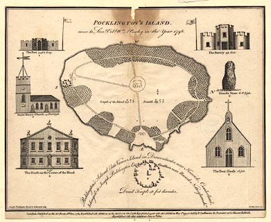 click to enlarge click to enlargeCT03.jpg item:- Armitt Library : 1959.191.6 Image © see bottom of page |
|
|
|
||
| evidence:- | old print:- Green 1810 (plate 32) |
|
| source data:- | Print, soft ground etching, Derwent Water from Crow Park, Keswick, Cumberland, by
William Green, Ambleside, Westmorland, 1810.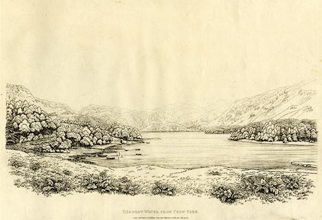 click to enlarge click to enlargeGN1232.jpg Plate 32 in Sixty Studies from Nature, 1810. printed at bottom:- "DERWENT WATER FROM CROW PARK. / Drawn and Engraved by William Green and Published at Ambleside, June 24, 1810." watermark:- "J WHATMAN / 1813" item:- Armitt Library : A6641.32 Image © see bottom of page |
|
|
|
||
| evidence:- | database:- Listed Buildings 2010 placename:- Derwent Isle House |
|
| source data:- | courtesy of English Heritage "DERWENT ISLE HOUSE / / / KESWICK / ALLERDALE / CUMBRIA / II / 71772 / NY2612122381" |
|
|
|
||
| evidence:- | old map:- Crosthwaite 1783-94 (Der) placename:- Island House |
|
| source data:- | Map, uncoloured engraving, An Accurate Map of the Matchless Lake
of Derwent, ie Derwent Water, scale about 3 inches to 1 mile, by
Peter Crosthwaite, Keswick, Cumberland, 1783, version published
1800.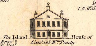 CT02Vgn8.jpg item:- Armitt Library : 1959.191.3 Image © see bottom of page |
|
|
|
||
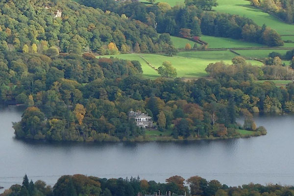 BZO07.jpg (taken 24.10.2013) |
||
|
|
||
 Lakes Guides menu.