 Old Cumbria Gazetteer
 |
 |
|
| Demesne Farm, Kirkoswald | ||
| Demesne Farm | ||
| locality:- | Kirkoswald | |
| civil parish:- | Kirkoswald (formerly Cumberland) | |
| county:- | Cumbria | |
| locality type:- | buildings | |
| coordinates:- | NY55604105 | |
| 1Km square:- | NY5541 | |
| 10Km square:- | NY54 | |
|
|
||
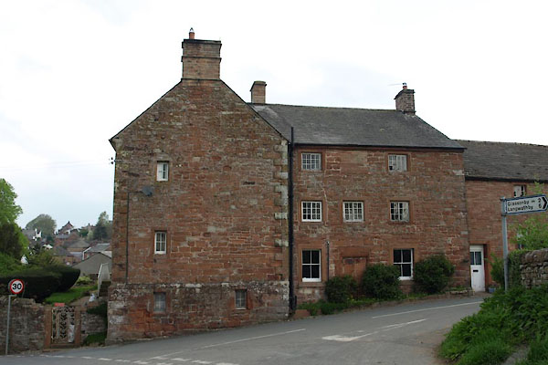 BUK87.jpg (taken 29.4.2011) 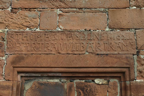 BUK88.jpg Date stone, transcribed in sections:- "KB / THOMAS BARTRA / DEUS VULT / BENET BARTRAM / 1622 / F" Read F=Fecerunt 'made [this house]' (taken 29.4.2011) |
||
|
|
||
| evidence:- | old map:- OS County Series (Cmd 40 6) placename:- Demesne |
|
| source data:- | Maps, County Series maps of Great Britain, scales 6 and 25
inches to 1 mile, published by the Ordnance Survey, Southampton,
Hampshire, from about 1863 to 1948. |
|
|
|
||
| evidence:- | database:- Listed Buildings 2010 placename:- Demesne Farm item:- date stone (1622) |
|
| source data:- | courtesy of English Heritage "DEMESNE FARMHOUSE / / / KIRKOSWALD / EDEN / CUMBRIA / II[star] / 73477 / NY5561241047" |
|
|
|
||
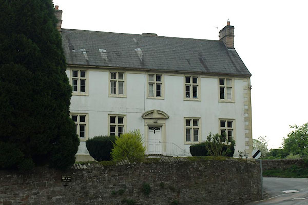 BUK86.jpg Newer wing facing the other road. (taken 29.4.2011) |
||
|
|
||
 Lakes Guides menu.