 Old Cumbria Gazetteer
 |
 |
|
| chapel, Dalton-in-Furness (4) | ||
| Street:- | Ulverston Road | |
| locality:- | Dalton-in-Furness | |
| civil parish:- | Dalton Town with Newton (formerly Lancashire) | |
| county:- | Cumbria | |
| locality type:- | church | |
| coordinates:- | SD23297416 | |
| 1Km square:- | SD2374 | |
| 10Km square:- | SD27 | |
| references:- | Listed Buildings 2010 |
|
|
|
||
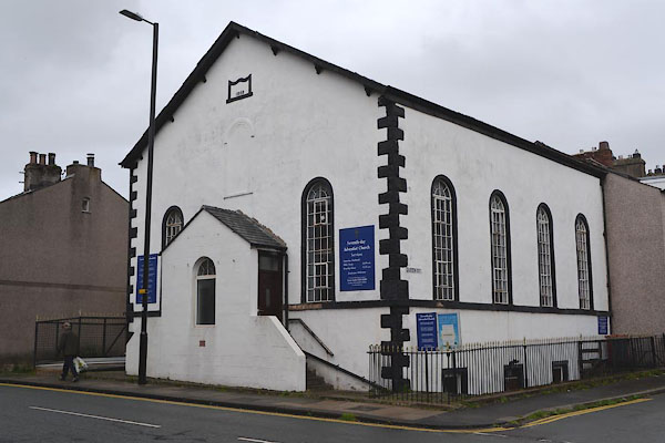 CGI84.jpg (taken 12.8.2017) 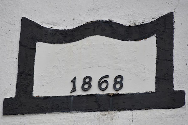 CGI85.jpg Plaque:- "[ ] / 1868" (taken 12.8.2017) |
||
|
|
||
| evidence:- | old map:- OS County Series (Lan 16 13) |
|
| source data:- | Maps, County Series maps of Great Britain, scales 6 and 25
inches to 1 mile, published by the Ordnance Survey, Southampton,
Hampshire, from about 1863 to 1948. "Hall" |
|
|
|
||
| evidence:- | database:- Listed Buildings 2010 |
|
| source data:- | courtesy of English Heritage "SEVENTH DAY ADVENTIST CHURCH WITH ATTACHED RAILINGS / / ULVERSTON ROAD / DALTON TOWN WITH NEWTON / BARROW IN FURNESS / CUMBRIA / II / 388627 / SD2329974162" |
|
| source data:- | courtesy of English Heritage "Church with attached railings. Dated 1868, altered. Ruled stucco, graduated slate roof. Tall single storey with half basement; 3x4 bays, gabled entrance front. Raised quoins. Later central porch with round-arched window; gable and steps to doors in each side. Continuous sill band to shortened round-arched windows having iron casements with glazing bars; blocked central window above porch and partially defaced date plaque; plain bargeboards. Left return: iron-railings around light-well; steps down to door and sash with glazing bars; ground-floor windows as front. Right return is the same except that there are 2 sashes with glazing bars to the half basement." |
|
|
|
||
 Lakes Guides menu.