 Old Cumbria Gazetteer
 |
 |
|
| canal aqueduct, Burgh by Sands | ||
| site name:- | Carlisle Canal | |
| site name:- | Grass Dike | |
| civil parish:- | Burgh by Sands (formerly Cumberland) | |
| civil parish:- | Bowness (formerly Cumberland) | |
| county:- | Cumbria | |
| locality type:- | canal aqueduct | |
| coordinates:- | NY28395949 | |
| 1Km square:- | NY2859 | |
| 10Km square:- | NY25 | |
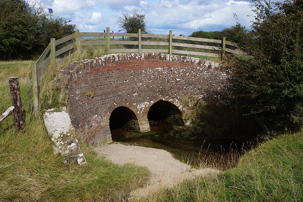
| SummaryText:- | Grass Dike down to here; Fresh Creek below. | |
|
|
||
 CBM35.jpg (taken 22.8.2014) 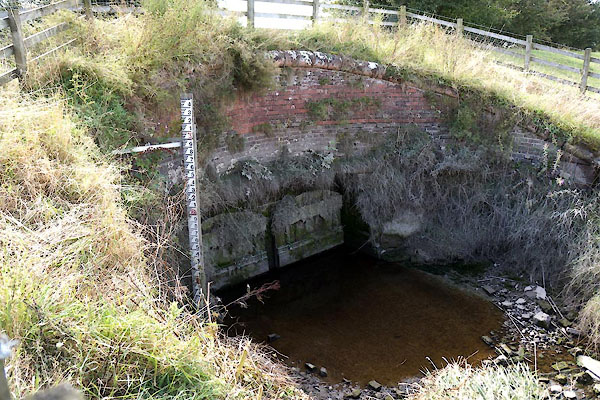 CBM38.jpg (taken 22.8.2014) |
||
|
|
||
| evidence:- | database:- Listed Buildings 2010 placename:- Canal Aqueduct |
|
| source data:- | courtesy of English Heritage "CANAL AQUEDUCT / / / BURGH BY SANDS / CARLISLE / CUMBRIA / II / 78240 / NY2839659476" |
|
| source data:- | courtesy of English Heritage "CANAL AQUEDUCT / / / BOWNESS / ALLERDALE / CUMBRIA / II / 71905 / NY2838359500" |
|
| source data:- | courtesy of English Heritage "Canal aqueduct, later railway bridge. 1819-1823 for the Carlisle Canal. Brick with red sandstone coping. 2 small round brick arches with plank doors on the seaward side, to prevent sea water from flowing into French Creek. Broadly spaced serpentine curved parapets. When the canal closed in 1853, it was converted to a railway and was in use until the closure of the Silloth Branch in 1964. Lies partly in Bowness C.P." |
|
|
|
||
 CBM36.jpg View E. (taken 22.8.2014)  CBM37.jpg View W. (taken 22.8.2014) |
||
|
|
||
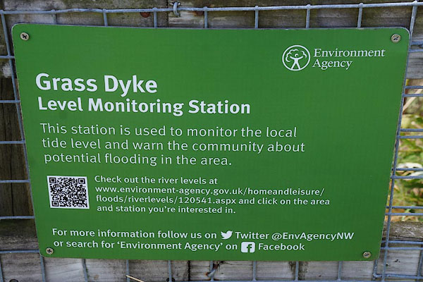 CBM39.jpg Notice, Grass Dyke Level Monitoring Station. (taken 22.8.2014) |
||
|
|
||
 Lakes Guides menu.