 Old Cumbria Gazetteer
 |
 |
|
| Carlisle Canal | ||
| Carlisle Navigation Canal | ||
| Solway Canal | ||
| civil parish:- | Bowness (formerly Cumberland) | |
| civil parish:- | Burgh by Sands (formerly Cumberland) | |
| civil parish:- | Beaumont (formerly Cumberland) | |
| civil parish:- | Carlisle (formerly Cumberland) | |
| county:- | Cumbria | |
| locality type:- | canal | |
| 1Km square:- | NY2462 (etc) | |
| 10Km square:- | NY26 | |
| 10Km square:- | NY25 | |
| 10Km square:- | NY35 | |
|
|
||
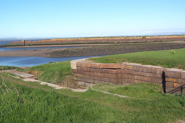 BMB13.jpg The sea lock end of the canal, at Port Carlisle. (taken 5.5.2006) 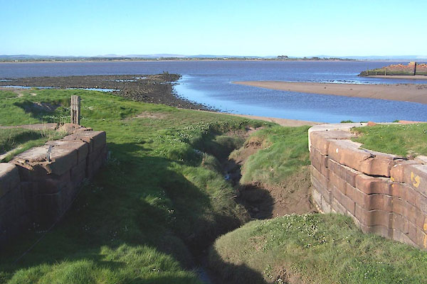 BMB14.jpg The sea lock end of the canal, at Port Carlisle. (taken 5.5.2006) |
||
|
|
||
| evidence:- | old map:- OS County Series (Cmd 16 13) |
|
| source data:- | Maps, County Series maps of Great Britain, scales 6 and 25
inches to 1 mile, published by the Ordnance Survey, Southampton,
Hampshire, from about 1863 to 1948. "Old Canal (Remains of)" |
|
|
|
||
| evidence:- | descriptive text:- Ford 1839 (3rd edn 1843) item:- fly boat |
|
| source data:- | Guide book, A Description of Scenery in the Lake District, by
Rev William Ford, published by Charles Thurnam, Carlisle, by W
Edwards, 12 Ave Maria Lane, Charles Tilt, Fleet Street, William
Smith, 113 Fleet Street, London, by Currie and Bowman,
Newcastle, by Bancks and Co, Manchester, by Oliver and Boyd,
Edinburgh, and by Sinclair, Dumfries, 1839. goto source goto sourcePage 107:- "... from the canal basin [Carlisle], a swift fly-boat conveys passengers to Bowness on the Solway, whence they can be comfortably and safely conveyed to Liverpool either by the Royal Victoria or Newcastle steam-packets, in a single tide." |
|
|
|
||
| evidence:- | old map:- Ford 1839 map |
|
| source data:- | Map, uncoloured engraving, Map of the Lake District of
Cumberland, Westmoreland and Lancashire, scale about 3.5 miles
to 1 inch, published by Charles Thurnam, Carlisle, and by R
Groombridge, 5 Paternoster Row, London, 3rd edn 1843.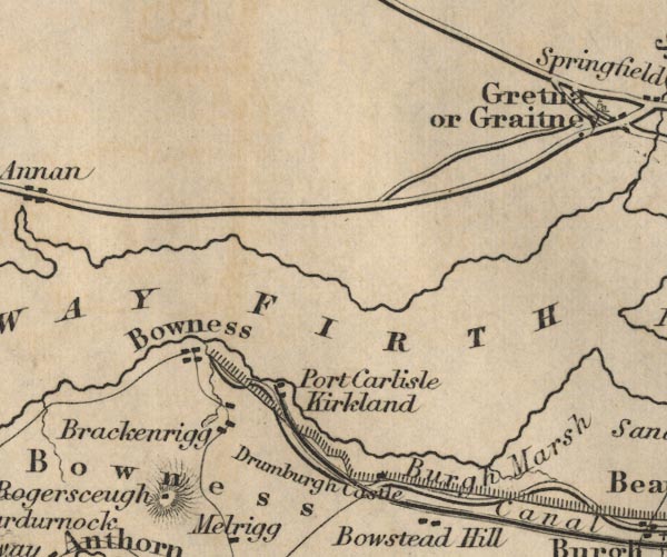 FD02NY26.jpg 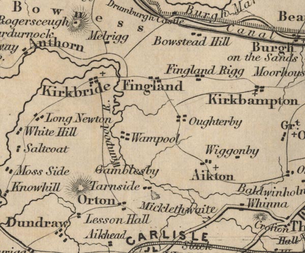 FD02NY25.jpg 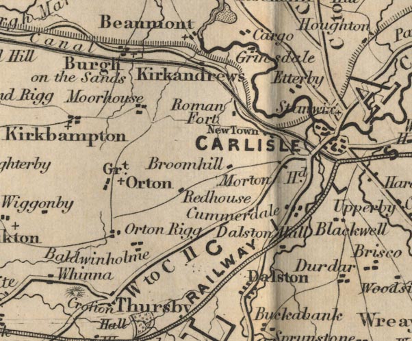 FD02NY35.jpg item:- JandMN : 100.1 Image © see bottom of page |
|
|
|
||
| evidence:- | old text:- Gents Mag |
|
| source data:- | Magazine, The Gentleman's Magazine or Monthly Intelligencer or
Historical Chronicle, published by Edward Cave under the
pseudonym Sylvanus Urban, and by other publishers, London,
monthly from 1731 to 1922. goto source Gentleman's Magazine 1839 part 1 p.518 From a review of The History and Antiquities of Carlisle:- ""The Ship Canal, extending from Carlisle to the Solway Frith near Bowness, was commenced in 1819, and completed in 1823, at the cost of about" |
|
|
|
||
| evidence:- | old text:- Gents Mag 1839 |
|
| source data:- | goto source Gentleman's Magazine 1839 part 1 p.519 "90,000l. It is eleven miles and a half in length, has eight locks, and is navigable by vessels of less than a hundred tons burden. The warehouses have been bonded since 1832, and at present contains goods to the value of upwards of 40,000l." |
|
|
|
||
| evidence:- | old text:- Harper 1907 |
|
| source data:- | Guidebook, The Manchester and Glasgow Road, by Charles G Harper,
published by Chapman and Hall Ltd, London, 1907. HP01p146.txt Page 146:- "..." "With the coming of the nineteenth century, some steps were taken to make Carlisle a port. It was thought that a ship-canal from a place called Fisher's Cross, on the Solway, to Carlisle, a distance of twelve miles, would make the ancient city a place of commercial importance; and accordingly the canal was cut, 1819-23, at a cost of ~90,000, and Fisher's Cross was dignified by the new name of "Port Carlisle." The enterprise never paid its way, any steps that might in after years have been taken to improve the position being rendered impossible by the coming of railways; while the irony of fate long ago overtook the canal, in its conversion into a railway." "..." |
|
|
|
||
| evidence:- | old painting:- item:- ship; canal lock |
|
| source data:- | Painting, watercolour, Early Morning, Carlisle from the Canal, Cumberland, by William
Henry Nutter, about 1842?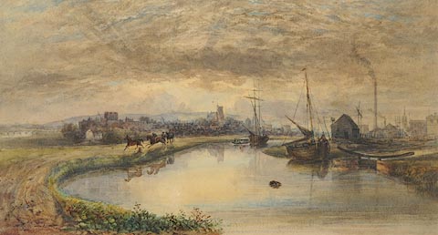 click to enlarge click to enlargePR0979.jpg Sunrise over a distant view of Carlisle with the canal basin in the foreground. Boats are moored beside the right bank, the masts of many more vessels being visible beyond the biuldings and chimneys associated with the canal. To left, three horses pass by, one being ridden and another being led. Beyond the fields in the midground lies Carlisle with its castle to left and cathedral in the centre. The Carlisle Journal 18.1.1867 mentions a number of watercolours by W H Nutter and in particular 'Carlisle from the Canal, a large picture painted from a sketch of 1840, when the scene depicted of a lighter being towed along the canal, might be witnessed at early morning any day ...' signed &dated at bottom left:- "W H Nutter 1866" item:- Tullie House Museum : 1959.121 Image © Tullie House Museum |
|
|
|
||
| evidence:- | old drawing:- |
|
| source data:- | Drawing, Carlisle from the Canal, Cumberland, by Matthew Ellis Nutter, 1841.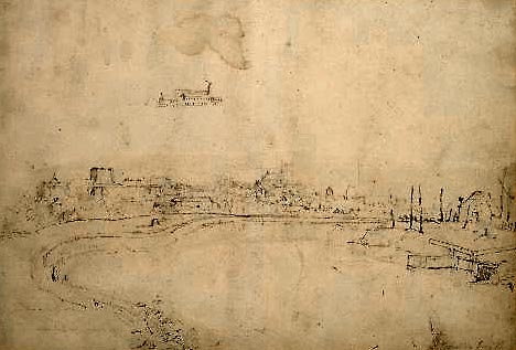 click to enlarge click to enlargePR1228.jpg Distant view of Carlisle from the canal basin. Tiny sketch of a factory above main composition. preliminary sketch for watercolour Carlisle Canal Basin, 1865? inscribed &dated at bottom right:- "Carlisle from the Canal 1841" item:- Tullie House Museum : 1978.108.75.21 Image © Tullie House Museum |
|
|
|
||
| evidence:- | old painting:- item:- boat; horse |
|
| source data:- | Painting, watercolour, Carlisle from the Canal, Carlisle, Cumberland, by Matthew Ellis
Nutter, about 1835.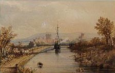 click to enlarge click to enlargePR0932.jpg A large boat, its sail furled, is drawn up the canal by two carthorses. Beyond lies Carlisle with distant hills beyond. item:- Tullie House Museum : 1939.33 Image © Tullie House Museum |
|
|
|
||
| Ramshaw, David: 1997: Carlisle Navigation Canal, The: P3 Publications (Carlisle, Cumbria)::
ISBN 0 9522098 5 3 |
||
|
|
||
| date:- | 1818 |
|
| period:- | 19th century, early | |
| period:- | 1810s | |
| Planned 1818, opened 1823. 11.5 miles from Carlisle to Fisher's Cross, which was renamed
Port Carlisle. The depth of water was 8.5 feet; the locks were 78 feet long, the gates
clearing 18 feet 4 inches. |
||
| By 1850s it was drained, filled in and converted to a railway. |
||
|
|
||
Lakes Guides menu.