 Old Cumbria Gazetteer
 |
 |
|
| Brow Top Farm, Sebergham | ||
| Brow Top Farm | ||
| civil parish:- | Sebergham (formerly Cumberland) | |
| county:- | Cumbria | |
| locality type:- | buildings | |
| coordinates:- | NY35984169 | |
| 1Km square:- | NY3541 | |
| 10Km square:- | NY34 | |
| references:- | Listed Buildings 2010 |
|
|
|
||
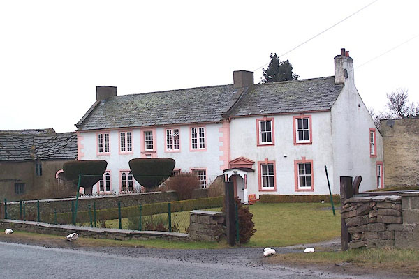 BLR81.jpg Brow Top on the left, Brisco House on the right. (taken 24.3.2006) 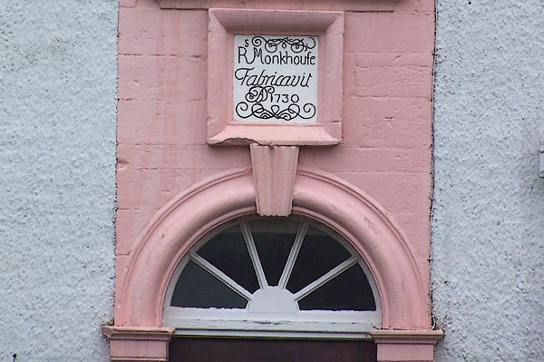 BLR82.jpg Date stone on Brow Top:- "Rs Monkhouse Fabricavit AD 1730" (taken 24.3.2006) |
||
|
|
||
| evidence:- | old map:- OS County Series (Cmd 38 6) placename:- King's Arms Inn |
|
| source data:- | Maps, County Series maps of Great Britain, scales 6 and 25
inches to 1 mile, published by the Ordnance Survey, Southampton,
Hampshire, from about 1863 to 1948. |
|
|
|
||
| evidence:- | database:- Listed Buildings 2010 placename:- Brow Top Farm item:- date stone (1730) |
|
| source data:- | courtesy of English Heritage "BROW TOP FARMHOUSE AND ADJOINING BARNS / / / SEBERGHAM / ALLERDALE / CUMBRIA / II / 72483 / NY3598041692" |
|
|
|
||
 Lakes Guides menu.