 Old Cumbria Gazetteer
 |
 |
|
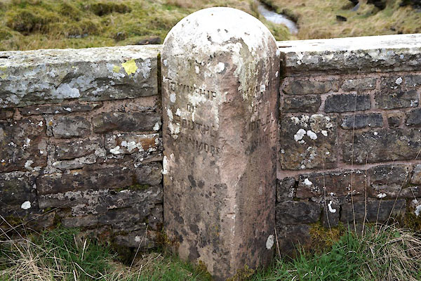
| boundary stone, Stainmore (4) | ||
| locality:- | Blackhause Bottom Bridge | |
| civil parish:- | Stainmore (formerly Westmorland) | |
| county:- | Cumbria | |
| locality type:- | boundary stone | |
| coordinates:- | NY86861301 | |
| 1Km square:- | NY8613 | |
| 10Km square:- | NY81 | |
| references:- | Listed Buildings 2010 |
|
|
|
||
 CAI12.jpg (taken 11.4.2014) |
||
|
|
||
| evidence:- | database:- Listed Buildings 2010 |
|
| source data:- | courtesy of English Heritage "BOUNDARY STONE SET AGAINST WEST PARAPET OF BLACKHAUSE BOTTOM BRIDGE / / / STAINMORE / EDEN / CUMBRIA / II / 73379 / NY8686013019" |
|
| source data:- | courtesy of English Heritage "Boundary stone; C19. Single stone c3 ft high with angled sides and segmental top. Inscribed in sans-serif lettering: TOWNSHIP OF SOUTH STAINMORE on south face, TOWNSHIP OF MIDDLE STAINMORE on north." |
|
|
|
||
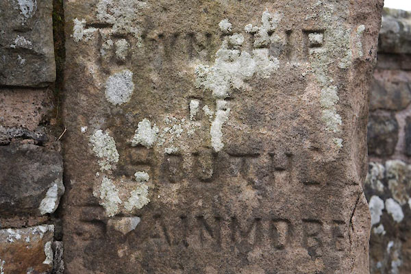 CAI13.jpg "TOWNSHIP / OF / SOUTH / STAINMORE" (taken 11.4.2014) 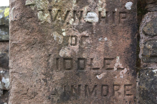 CAI14.jpg "[ ]OWNSHIP / OF / [ ]IDDLE / [ ]AINMORE" (taken 11.4.2014) |
||
|
|
||
 Lakes Guides menu.