 Old Cumbria Gazetteer
 |
 |
|
| boundary stone, Kirkoswald | ||
| locality:- | Renwick (near) | |
| civil parish:- | Kirkoswald (formerly Cumberland) | |
| county:- | Cumbria | |
| locality type:- | boundary stone (?) | |
| coordinates:- | NY60224308 | |
| 1Km square:- | NY6043 | |
| 10Km square:- | NY64 | |
|
|
||
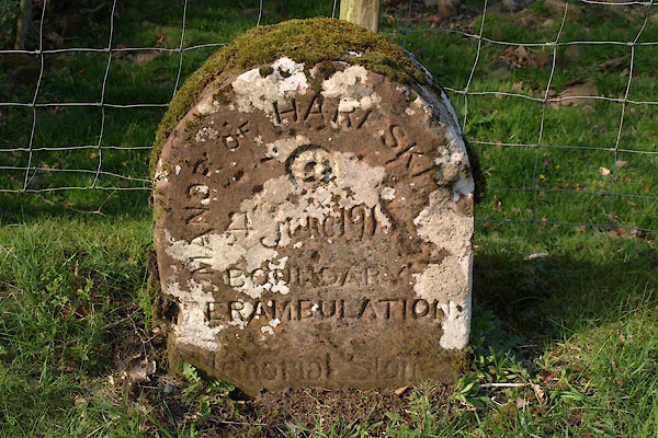 BUK09.jpg Inscribed stone:- "MANOR OF HARESK[ ] / [4 June 191 ] / BOUNDARY / [P]ERAMBULATIO[N] / Manorial Stone" (taken 23.4.2011) |
||
|
|
||
| evidence:- | database:- Listed Buildings 2010 |
|
| source data:- | courtesy of English Heritage "MANORIAL BOUNDARY STONE, EAST OF RAVEN BRIDGE / / / KIRKOSWALD / EDEN / CUMBRIA / II / 73513 / NY6021343091" |
|
| source data:- | courtesy of English Heritage "Manorial boundary stone. Inscribed and dated, MANOR OF HARESCEUGH/4 JUNE 1913/ BOUNDARY PERAMBULATION/MANORIAL STONE. Red sandstone, with incised letters. Small dressed stone with rounded top. Set at road side on junction of 2 roads, marking the western boundary of the manor." |
|
|
|
||
 Lakes Guides menu.