 Old Cumbria Gazetteer
 |
 |
|
| Bassenthwaite Church Room, Bassenthwaite | ||
| Bassenthwaite Church Room | ||
| Bassenthwaite Chapel | ||
| locality:- | Chapel | |
| civil parish:- | Bassenthwaite (formerly Cumberland) | |
| county:- | Cumbria | |
| locality type:- | village hall | |
| locality type:- | chapel (ex) | |
| locality type:- | church (ex) | |
| coordinates:- | NY22783164 | |
| 1Km square:- | NY2231 | |
| 10Km square:- | NY23 | |
| references:- | Listed Buildings 2010 |
|
|
|
||
| MN photo:- |
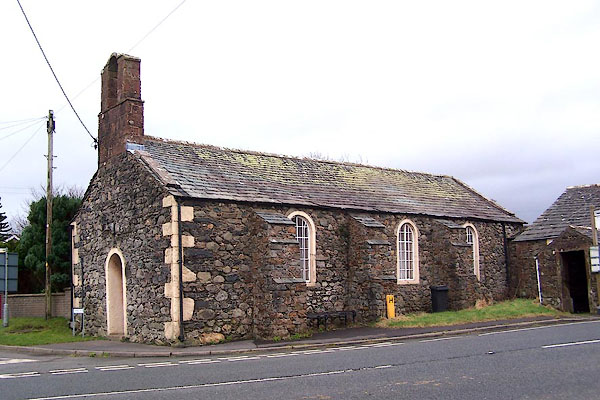
This was a chapel of ease for Bassenthwaite, built in the 15th century? because the
church, by the lake, was a long way from the village. It was replaced by St John's
Church, and is now a meeting room. |
|
 BLO46.jpg (taken 20.1.2006) |
||
|
|
||
| evidence:- | old map:- OS County Series (Cmd 55 4) |
|
| source data:- | Maps, County Series maps of Great Britain, scales 6 and 25
inches to 1 mile, published by the Ordnance Survey, Southampton,
Hampshire, from about 1863 to 1948. "Church (Chapel of Ease)" |
|
|
|
||
| evidence:- | probably old map:- Ogilby 1675 (plate 96) |
|
| source data:- | Road strip map, hand coloured engraving, the Road from Kendal to
Cockermouth, and the Road from Egremond to Carlisle, scale about
1 inch to 1 mile, by John Ogilby, London, 1675.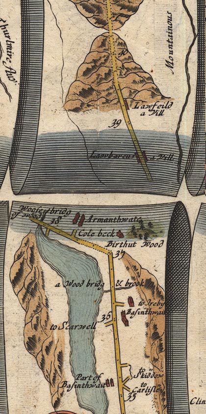 OG96m035.jpg In mile 36, Cumberland. church on the right of the road at:- "Basinthwait" item:- JandMN : 22 Image © see bottom of page |
|
|
|
||
| evidence:- | old map:- Crosthwaite 1783-94 (Bas) placename:- Bassenthwaite Chapel |
|
| source data:- | Map, uncoloured engraving, An Accurate Map of Broadwater or
Bassenthwaite Lake, scale about 3 inches to 1 mile, by Peter
Crosthwaite, Keswick, Cumberland, 1783, version published 1800.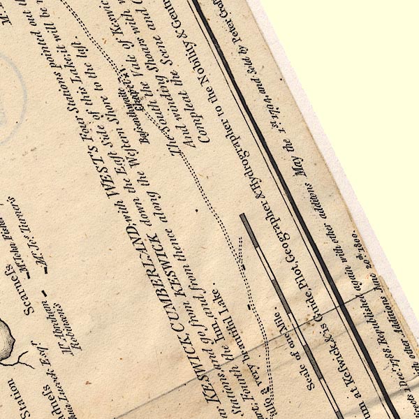 CT6NY23F.jpg "Bassenthwaite Chapel" Marked by a cross (x) by the road round the lake. item:- Armitt Library : 1959.191.4 Image © see bottom of page |
|
|
|
||
| evidence:- | old text:- Clarke 1787 placename:- Bassenthwaite Chapel |
|
| source data:- | Guide book, A Survey of the Lakes of Cumberland, Westmorland,
and Lancashire, written and published by James Clarke, Penrith,
Cumberland, and in London etc, 1787; published 1787-93. goto source goto sourcePage 97:- "..." "We now come to Bassenthwaite chapel, a little, mean, low building; the salary is proportionable, and the curate usually officiates at both church and chapel. Several of the inhabitants of the lower side of Bassenthwaite, commonly called the Halls, or Hawes, were at a great distance from the church; on this account they petitioned Edward Storey Bishop of Carlisle, for leave to build a chapel of ease at this place. He granted their request; the chapel was built, and covered with thatch A.D. 1472, but has since been slated. The Bishop obliged the inhabitants to set out, for the curate's use, an acre of land, and to raise L.50 for the purchasing of more lands for the same purpose. ..." |
|
|
|
||
| evidence:- | old map:- Clarke 1787 map (Bassenthwaite Lake) |
|
| source data:- | Map, A Map of Broadwater and its Environs, ie Bassenthwaite
Lake, scale about 6.5 ins to 1 mile, by James Clarke, engraved
by Neele, 352 Strand, published by James Clarke, Penrith,
Cumberland and in London etc, 1787.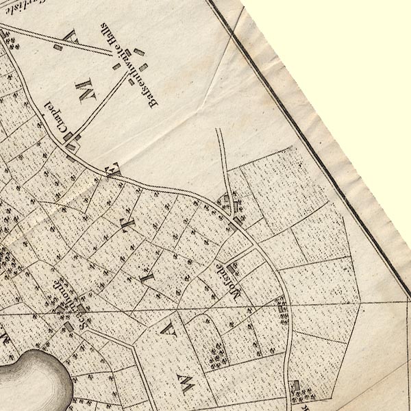 CL8NY23F.jpg "Chapel" item:- private collection : 10.8 Image © see bottom of page |
|
|
|
||
| evidence:- | probably descriptive text:- Ford 1839 (3rd edn 1843) |
|
| source data:- | Guide book, A Description of Scenery in the Lake District, by
Rev William Ford, published by Charles Thurnam, Carlisle, by W
Edwards, 12 Ave Maria Lane, Charles Tilt, Fleet Street, William
Smith, 113 Fleet Street, London, by Currie and Bowman,
Newcastle, by Bancks and Co, Manchester, by Oliver and Boyd,
Edinburgh, and by Sinclair, Dumfries, 1839. goto source Page 87:- "[Haws village] ... A chapel of ease is placed here, totally devoid of a single charm. ..." |
|
|
|
||
| evidence:- | old map:- Ford 1839 map |
|
| source data:- | Map, uncoloured engraving, Map of the Lake District of
Cumberland, Westmoreland and Lancashire, scale about 3.5 miles
to 1 inch, published by Charles Thurnam, Carlisle, and by R
Groombridge, 5 Paternoster Row, London, 3rd edn 1843.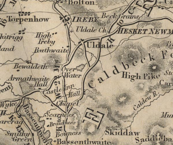 FD02NY23.jpg "Chapel" item:- JandMN : 100.1 Image © see bottom of page |
|
|
|
||
| evidence:- | perhaps old map:- Nurse 1918 |
|
| source data:- | Map, The Diocese of Carlisle, Cumberland, Westmorland, and
Lancashire North of the Sands, scale about 4 miles to 1 inch, by
Rev Euston J Nurse, published by Charles Thurnam and Sons, 11
English Street, Carlisle, Cumberland, 2nd edn 1939.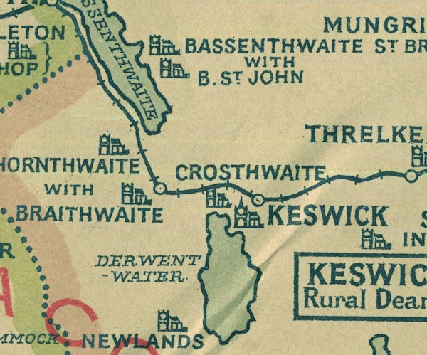 NUR1NY22.jpg "BASSENTHWAITE ST. BRIDGET WITH B. ST. JOHN" item:- JandMN : 27 Image © see bottom of page |
|
|
|
||
| evidence:- | database:- Listed Buildings 2010 placename:- Bassenthwaite Church Room |
|
| source data:- | courtesy of English Heritage "BASSENTHWAITE CHURCH ROOM / / / BASSENTHWAITE / ALLERDALE / CUMBRIA / II / 72106 / NY2278231641" |
|
| source data:- | courtesy of English Heritage "Chapel now church room. 1805 replacing earlier chapel. Cobble rubble with flush painted quoins and stepped buttresses. Graduated greenslate roof with coped gables and west open bellcote of red sandstone. Single storey, 3 bays. West round-headed doorway and round-headed windows with glazing bars in painted stone surrounds. Interior has simple timber roof-trusses on shaped corbels, and plain panelled dado. Extension dated 1862 is not of interest. Was used as a chapel-of-ease for Bassenthwaite Parish until 1878, when a new church was built nearby. See Transactions Cumberland & Westmorland Antiquarian &Archaeological Society, new series, 1xvi, p277." |
|
|
|
||
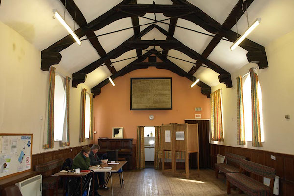 BYH60.jpg In use as a Poling Station. (taken 2.5.2013) 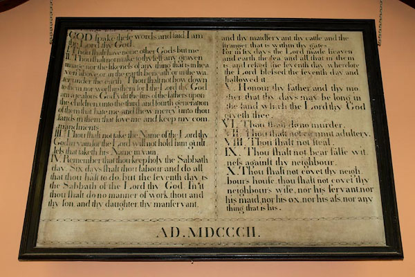 BYH61.jpg The Ten Commandments (taken 2.5.2013) |
||
|
|
||
Lakes Guides menu.