 Old Cumbria Gazetteer
 |
 |
|
|
| Ambleside: Church Street | |||
| Church Street | |||
| locality:- | Ambleside | ||
| civil parish:- | Lakes (formerly Westmorland) | ||
| county:- | Cumbria | ||
| locality type:- | street | ||
| coordinates:- | NY37580434 | ||
| 1Km square:- | NY3704 | ||
| 10Km square:- | NY30 | ||
| references:- | Listed Buildings 2010 |
||
|
|
|||
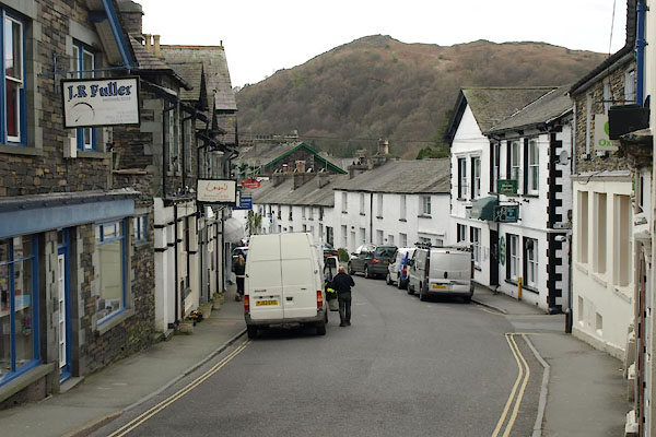 BWE63.jpg (taken 5.4.2012) |
|||
|
|
|||
| evidence:- | old map:- OS County Series (Wmd 26 10) placename:- Church Street |
||
| source data:- | Maps, County Series maps of Great Britain, scales 6 and 25
inches to 1 mile, published by the Ordnance Survey, Southampton,
Hampshire, from about 1863 to 1948. |
||
|
|
|||
| evidence:- | database:- Listed Buildings 2010 |
||
| source data:- | courtesy of English Heritage "/ 40484 / CHURCH STREET / LAKES / SOUTH LAKELAND / CUMBRIA / II / 450588 / NY3758904347" |
||
|
|
|||
| mapping:- |  Ambleside: Market Place Ambleside: Lake Road Ambleside: Market Place Ambleside: Lake Road[Ambleside: St Mary's Lane] Ambleside: Market Place Ambleside: Lake Road Ambleside: Market Place Ambleside: Lake Road[Ambleside: St Mary's Lane][Ambleside: St Mary's Lane][Ambleside: King Street] [Ambleside: King Street] Ambleside: Compston Street Ambleside: Compston Street Ambleside: Rothay Road Ambleside: Compston Road[Ambleside: Kelsick Road] Ambleside: Rothay Road Ambleside: Compston Road[Ambleside: Kelsick Road] |
||
|
|
|||
Lakes Guides menu.