 Old Cumbria Gazetteer
 |
 |
|
| Moot Hall, Ireby | ||
| Moot Hall | ||
| locality:- | Ireby | |
| civil parish:- | Ireby (formerly Cumberland) | |
| county:- | Cumbria | |
| locality type:- | buildings | |
| coordinates:- | NY23783873 | |
| 1Km square:- | NY2338 | |
| 10Km square:- | NY23 | |
|
|
||
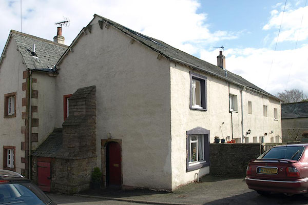 BSL42.jpg 1 Moot Hall (taken 4.4.2010) 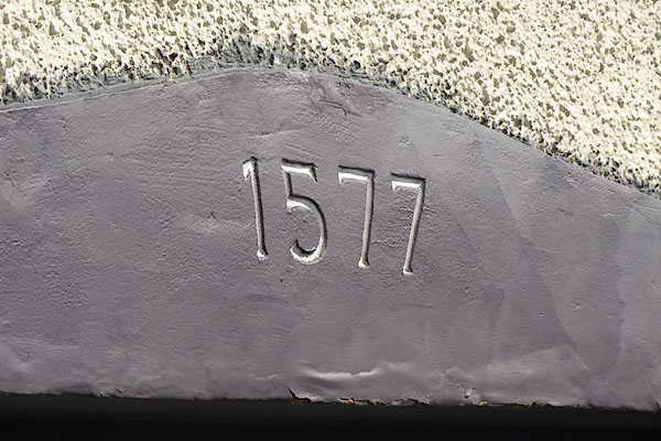 BSL43.jpg Date stone "1577" it looks very freshly cut? (taken 4.4.2010) |
||
|
|
||
| evidence:- | old map:- OS County Series (Cmd 37 13) placename:- Moot Hall |
|
| source data:- | Maps, County Series maps of Great Britain, scales 6 and 25
inches to 1 mile, published by the Ordnance Survey, Southampton,
Hampshire, from about 1863 to 1948. |
|
|
|
||
| evidence:- | database:- Listed Buildings 2010 placename:- Moot Hall |
|
| source data:- | courtesy of English Heritage "MOOT HALL / 1, 2 AND 3 / / IREBY AND ULDALE / ALLERDALE / CUMBRIA / II / 72435 / NY2379438731" |
|
|
|
||
| evidence:- | database:- Listed Buildings 2010 |
|
| source data:- | courtesy of English Heritage "GARDEN WALL AND DRINKING TROUGH IN FRONT OF MOOT HALL / / / IREBY AND ULDALE / ALLERDALE / CUMBRIA / II / 72436 / NY2381038730" |
|
|
|
||
 Lakes Guides menu.