 Old Cumbria Gazetteer
 |
 |
|
| Wasdale Crag, Shap Rural | ||
| Wasdale Crag | ||
| locality:- | Shap Fells | |
| civil parish:- | Shap Rural (formerly Westmorland) | |
| county:- | Cumbria | |
| locality type:- | rocks | |
| coordinates:- | NY55750845 (etc) | |
| 1Km square:- | NY5508 | |
| 10Km square:- | NY50 | |
| SummaryText:- | Shap Pink Quarry has eaten into the crag. | |
|
|
||
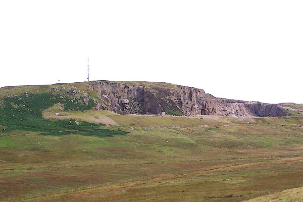 BJT44.jpg (taken 22.8.2005) |
||
|
|
||
| evidence:- | old map:- OS County Series placename:- Wasdale Crag |
|
| source data:- | Maps, County Series maps of Great Britain, scales 6 and 25
inches to 1 mile, published by the Ordnance Survey, Southampton,
Hampshire, from about 1863 to 1948. "Wasdale Crag" |
|
|
|
||
| evidence:- | old map:- Garnett 1850s-60s H placename:- Wasdale Crag |
|
| source data:- | Map of the English Lakes, in Cumberland, Westmorland and
Lancashire, scale about 3.5 miles to 1 inch, published by John
Garnett, Windermere, Westmorland, 1850s-60s.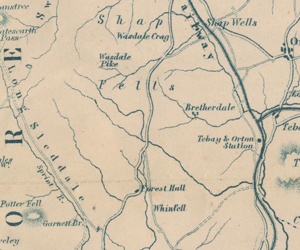 GAR2NY50.jpg "Wasdale Crag" no symbol item:- JandMN : 82.1 Image © see bottom of page |
|
|
|
||
 Lakes Guides menu.