 Old Cumbria Gazetteer
 |
 |
|
| Underhill Station, Millom Without | ||
| Underhill Station | ||
| Under Hill Station | ||
| site name:- | Whitehaven and Furness Junction Railway | |
| civil parish:- | Millom Without (formerly Cumberland) | |
| county:- | Cumbria | |
| locality type:- | railway station (gone) | |
| coordinates:- | SD18608281 | |
| 1Km square:- | SD1882 | |
| 10Km square:- | SD18 | |
| SummaryText:- | Proposed about 1859? not built? | |
|
|
||
| evidence:- | old map:- OS County Series (Cmd 88 11) placename:- Underhill Station item:- railway signal; railway bridge |
|
| source data:- | Maps, County Series maps of Great Britain, scales 6 and 25
inches to 1 mile, published by the Ordnance Survey, Southampton,
Hampshire, from about 1863 to 1948.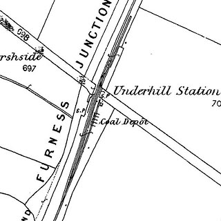 click to enlarge click to enlargeCSRY0112.jpg "Underhill Station / Coal Depot / S.P." |
|
|
|
||
| evidence:- | old map:- Garnett 1850s-60s H placename:- Under Hill Station |
|
| source data:- | Map of the English Lakes, in Cumberland, Westmorland and
Lancashire, scale about 3.5 miles to 1 inch, published by John
Garnett, Windermere, Westmorland, 1850s-60s.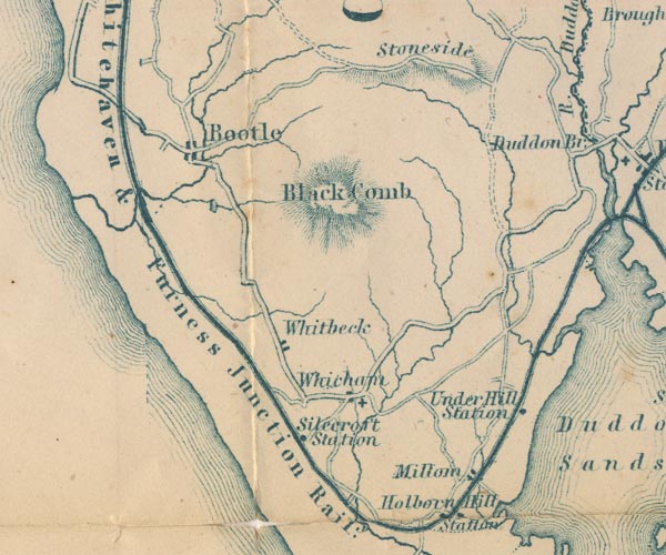 GAR2SD18.jpg "Under Hill Station" dot by railway item:- JandMN : 82.1 Image © see bottom of page |
|
|
|
||
 Lakes Guides menu.