 Old Cumbria Gazetteer
 |
 |
|
| Old School House, Nenthall | ||
| locality:- | Nenthall | |
| civil parish:- | Alston Moor (formerly Cumberland) | |
| county:- | Cumbria | |
| locality type:- | buildings | |
| locality type:- | school (ex) | |
| coordinates:- | NY75504582 | |
| 1Km square:- | NY7545 | |
| 10Km square:- | NY74 | |
|
|
||
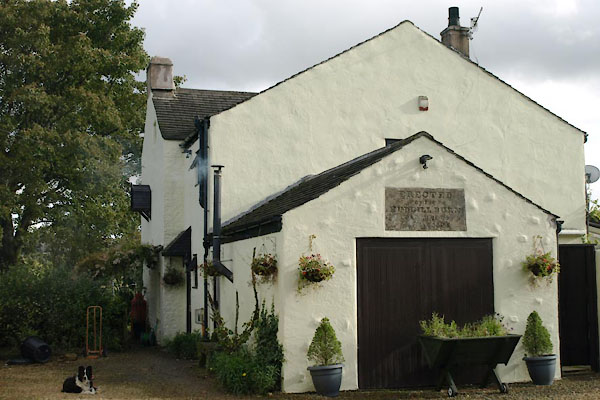 BXL31.jpg (taken 28.9.2012) 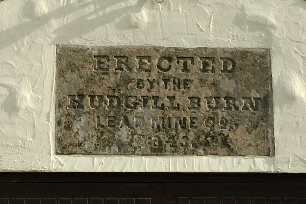 BXL32.jpg Plaque:- "ERECTED / BY THE / HUDGILL BURN / LEAD MINE CO. / 1840." (taken 28.9.2012) |
||
|
|
||
| evidence:- | old map:- OS County Series (Cmd 34 10) |
|
| source data:- | Maps, County Series maps of Great Britain, scales 6 and 25
inches to 1 mile, published by the Ordnance Survey, Southampton,
Hampshire, from about 1863 to 1948. "School" |
|
|
|
||
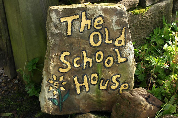 BXL33.jpg Sign. (taken 28.9.2012) |
||
|
|
||
 Lakes Guides menu.