 Old Cumbria Gazetteer
 |
 |
|
|
| road, Ulverston to Broughton | |||
| Ulverston to Broughton in Furness | |||
| Broughton in Furness to Ulverston | |||
| civil parish:- | Ulverston (formerly Lancashire) | ||
| civil parish:- | Mansriggs (formerly Lancashire) | ||
| civil parish:- | Osmotherley (formerly Lancashire) | ||
| civil parish:- | Lowick (formerly Lancashire) | ||
| civil parish:- | Blawith and Subberthwaite (formerly Lancashire) | ||
| civil parish:- | Kirkby Ireleth (formerly Lancashire) | ||
| civil parish:- | Broughton West (formerly Lancashire) | ||
| county:- | Cumbria | ||
| locality type:- | route | ||
| 10Km square:- | SD27 | ||
| 10Km square:- | SD28 | ||
|
|
|||
| evidence:- | old map:- Bowen and Kitchin 1760 |
||
| source data:- | Map, hand coloured engraving, A New Map of the Counties of
Cumberland and Westmoreland Divided into their Respective Wards,
scale about 4 miles to 1 inch, by Emanuel Bowen and Thomas
Kitchin et al, published by T Bowles, Robert Sayer, and John
Bowles, London, 1760.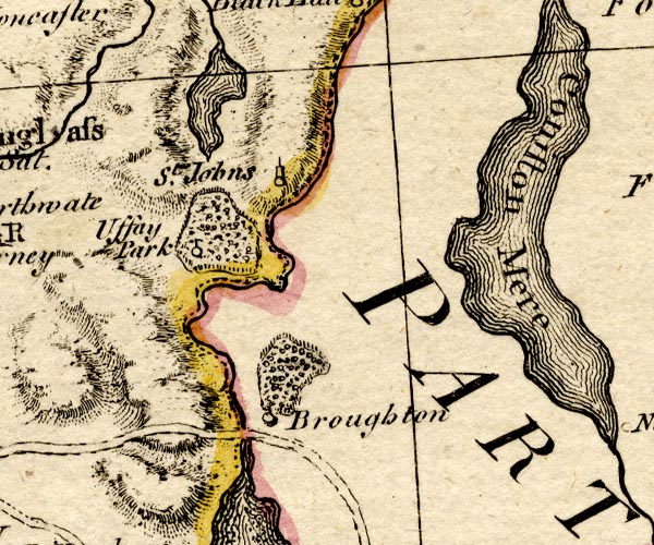 BO18SD18.jpg double line, solid 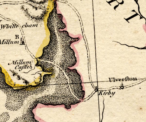 BO18SD17.jpg double line, solid? item:- Armitt Library : 2008.14.10 Image © see bottom of page |
||
|
|
|||
| evidence:- | road book:- Cary 1798 (2nd edn 1802) |
||
| source data:- | Road book, itineraries, Cary's New Itinerary, by John Cary, 181
Strand, London, 2nd edn 1802. goto source goto source click to enlarge click to enlargeC38319.jpg page 319-320 "[LONDON to Whitehaven.] Another Road across Lancaster Sands." part of item:- JandMN : 228.1 Image © see bottom of page |
||
|
|
|||
| evidence:- | old map:- Laurie and Whittle 1806 |
||
| source data:- | Road map, Completion of the Roads to the Lakes, scale about 10
miles to 1 inch, by Nathaniel Coltman? 1806, published by Robert
H Laurie, 53 Fleet Street, London, 1834. click to enlarge click to enlargeLw18.jpg bold line; 'Principal Travelling Roads' item:- private collection : 18.18 Image © see bottom of page |
||
|
|
|||
| places:- | Ulverston Broughton Beck, Osmotherley Gawthwaite, Blawith and Subberthwaite Grizebeck, Kirkby Ireleth Broughton in Furness |
||
|
|
|||
| places:- | alternative route Ulverston Greenodd Lowick Gawthwaite, Blawith and Subberthwaite Grizebeck, Kirkby Ireleth Broughton in Furness |
||
|
|
|||
Lakes Guides menu.