 Old Cumbria Gazetteer
 |
 |
|
| Old Schoolhouse, Kirkandrews | ||
| Old Schoolhouse | ||
| Rhodds School | ||
| locality:- | Rhodds | |
| civil parish:- | Kirkandrews (formerly Cumberland) | |
| county:- | Cumbria | |
| locality type:- | buildings | |
| locality type:- | school (once) | |
| coordinates:- | NY36877172 | |
| 1Km square:- | NY3671 | |
| 10Km square:- | NY37 | |
|
|
||
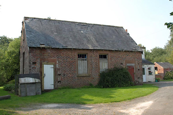 BTM49.jpg (taken 3.9.2010) 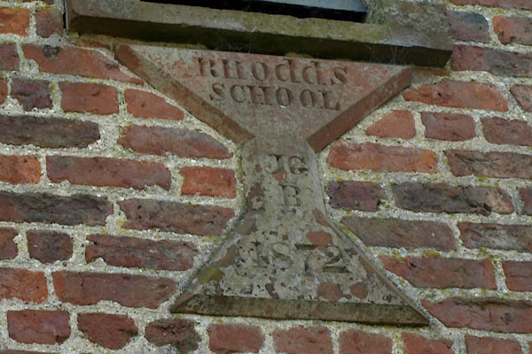 BTM50.jpg Plaque:- "RHOddS / SCHOOL / JG / B / 1872" (taken 3.9.2010) |
||
|
|
||
| evidence:- | old map:- OS County Series (Cmd 6) placename:- Bushhead |
|
| source data:- | Maps, County Series maps of Great Britain, scales 6 and 25
inches to 1 mile, published by the Ordnance Survey, Southampton,
Hampshire, from about 1863 to 1948. "Bushhead (Endowed School)" |
|
|
|
||
 Lakes Guides menu.