 Old Cumbria Gazetteer
 |
 |
|
| Glenwillie Bridge, Great Corby | ||
| Glenwillie Bridge | ||
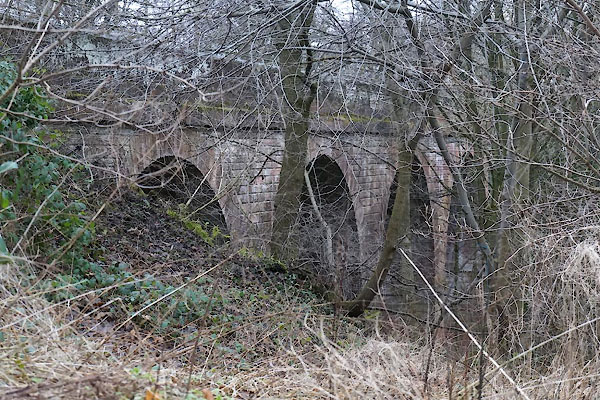
| Corby Beck Viaduct | ||
| site name:- | Newcastle and Carlisle Railway | |
| site name:- | Corby Beck | |
| locality:- | Great Corby | |
| civil parish:- | Wetheral (formerly Cumberland) | |
| county:- | Cumbria | |
| locality type:- | railway viaduct | |
| locality type:- | viaduct | |
| coordinates:- | NY47275486 | |
| 1Km square:- | NY4754 | |
| 10Km square:- | NY45 | |
| references:- | OS County Series |
|
|
|
||
 CFU12.jpg (taken 20.1.2017) 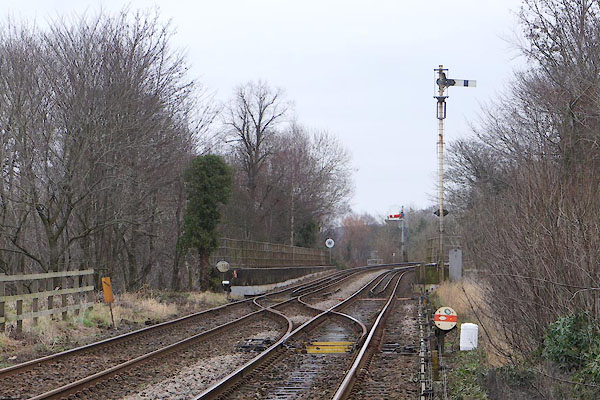 CFU11.jpg (taken 20.1.2017) |
||
|
|
||
| evidence:- | old map:- OS County Series (Cmd 24 6) placename:- Glenwillie Bridge |
|
| source data:- | Maps, County Series maps of Great Britain, scales 6 and 25
inches to 1 mile, published by the Ordnance Survey, Southampton,
Hampshire, from about 1863 to 1948. |
|
|
|
||
| evidence:- | database:- Listed Buildings 2010 placename:- Corby Viaduct |
|
| source data:- | courtesy of English Heritage "CORBY VIADUCT / / / WETHERAL / CARLISLE / CUMBRIA / II / 77705 / NY4728454859" |
|
| source data:- | courtesy of English Heritage "Viaduct over Corby Beck (not to be confused with Corby Bridge further west) 1830-4, by Francis Giles, for the Newcastle &Carlisle Railway Company. Red sandstone. 7 arches of 13 metre spans on 6 piers, giving a height of 23 metres and 160 metres long. Similar architectural details as Corby Bridge. Henry Howard used this viaduct as an entrance gate to Corby Castle, having his coat of arms carved above the central arch of both faces and building a road through the valley beside Corby Beck. An early and important railway structure, forming an impressive landscape feature." |
|
|
|
||
 Lakes Guides menu.