 Old Cumbria Gazetteer
 |
 |
|
| Bridekirk Dovenby School, Dovenby | ||
| Bridekirk Dovenby School | ||
| locality:- | Dovenby (by) | |
| civil parish:- | Bridekirk (formerly Cumberland) | |
| county:- | Cumbria | |
| locality type:- | school | |
| coordinates:- | NY10533342 | |
| 1Km square:- | NY1033 | |
| 10Km square:- | NY13 | |
| references:- | OS County Series |
|
|
|
||
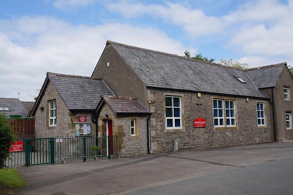 CAU82.jpg (taken 30.5.2014) 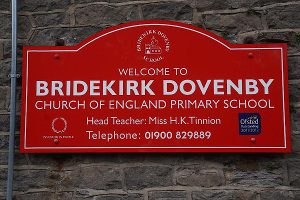 CAU83.jpg Sign. (taken 30.5.2014) |
||
|
|
||
| evidence:- | old map:- OS County Series (Cmd 45 15) placename:- Dovenby School |
|
| source data:- | Maps, County Series maps of Great Britain, scales 6 and 25
inches to 1 mile, published by the Ordnance Survey, Southampton,
Hampshire, from about 1863 to 1948. "Dovenby School (Endowed)" |
|
|
|
||
| evidence:- | old map:- Donald 1774 (Cmd) |
|
| source data:- | Map, hand coloured engraving, 3x2 sheets, The County of Cumberland, scale about 1
inch to 1 mile, by Thomas Donald, engraved and published by Joseph Hodskinson, 29
Arundel Street, Strand, London, 1774.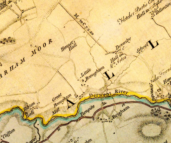 D4NY03SE.jpg "School" school, E of Dovenby item:- Carlisle Library : Map 2 Image © Carlisle Library |
|
|
|
||
 Lakes Guides menu.