Old Cumbria Gazetteer
 |
 |
|
||
| Stanley Ghyll Beck | ||||
| runs into:- |  Esk, River (2) Esk, River (2) |
|||
|
|
||||
| locality:- | Stanley Ghyll | |||
| civil parish:- | Eskdale (formerly Cumberland) | |||
| county:- | Cumbria | |||
| locality type:- | river | |||
| 1Km square:- | SD1799 (etc) | |||
| 10Km square:- | SD19 | |||
|
|
||||
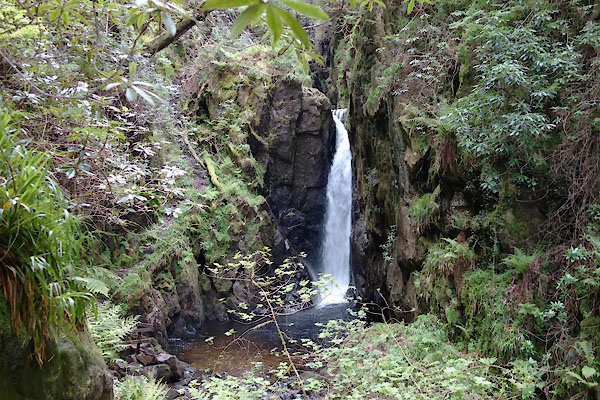
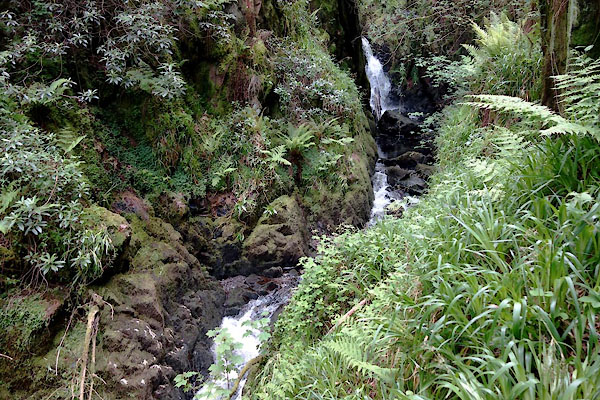 CDF43.jpg (taken 4.6.2015)  CDF53.jpg (taken 4.6.2015) |
||||
|
|
||||
| evidence:- | old map:- OS County Series (Cmd 83 2) placename:- Stanley Gill |
|||
| source data:- | Maps, County Series maps of Great Britain, scales 6 and 25
inches to 1 mile, published by the Ordnance Survey, Southampton,
Hampshire, from about 1863 to 1948. |
|||
|
|
||||
| evidence:- | old text:- Green 1810 placename:- Stanley Gill |
|||
| source data:- | Set of prints, soft ground etchings, Sixty Studies from Nature,
by William Green, Ambleside, Westmorland, drawn 1808-10,
published 1810. goto source page 99:- "When the traveller is in Eskdale, ... on his road to Wastdale, he will be near an ancient building called Dale Garth Hall; and if he should have the curiosity to see Stanley Gill, he may have access to it by applying at the hall; the waterfall part of the Gill, is more than half a mile on the left." "The late --- Stanley, Esq. of Ponsonby (to whose son this property now" goto sourcepage 100:- "belongs) made an excellent foot road on the banks of the Gill, which road three times changes sides by three bridges crossing the Gill; and this, with other improvements, are highly creditable to the late proprietor. - The chasm is awfully sublime, the rocks rising almost perpendicular over their bases, from the grisly sides of which, impend trees in the richest wildness. ..." |
|||
|
|
||||
| evidence:- | old map:- Garnett 1850s-60s H placename:- Stanley Gill |
|||
| source data:- | Map of the English Lakes, in Cumberland, Westmorland and
Lancashire, scale about 3.5 miles to 1 inch, published by John
Garnett, Windermere, Westmorland, 1850s-60s.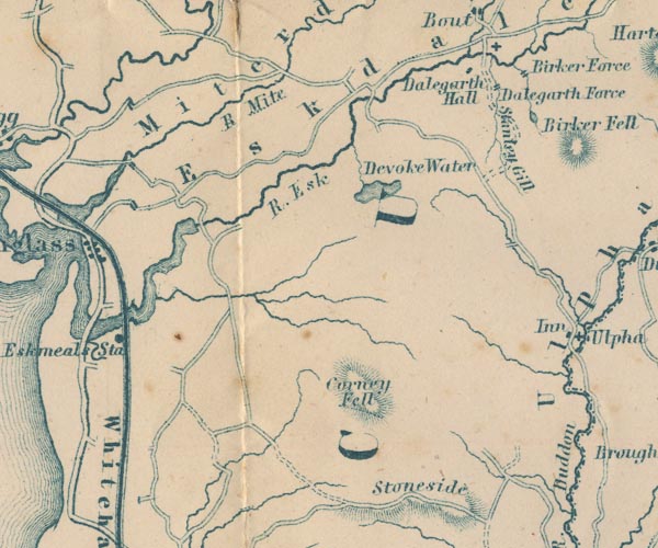 GAR2SD19.jpg "Stanley Gill" wiggly line, river item:- JandMN : 82.1 Image © see bottom of page |
|||
|
|
||||
| places:- |
|
|||
Lakes Guides menu.