 Old Cumbria Gazetteer
 |
 |
|
| Kirk Bridge, Garsdale | ||
| Kirk Bridge | ||
| site name:- | Clough River | |
| locality:- | Garsdale | |
| locality:- | Garsdale valley | |
| civil parish:- | Garsdale (formerly Yorkshire) | |
| county:- | Cumbria | |
| locality type:- | bridge | |
| coordinates:- | SD74508963 | |
| 1Km square:- | SD7489 | |
| 10Km square:- | SD78 | |
|
|
||
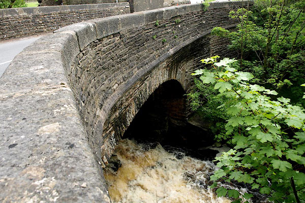 BQV12.jpg (taken 18.6.2009) |
||
|
|
||
| evidence:- | old map:- OS County Series |
|
| source data:- | Maps, County Series maps of Great Britain, scales 6 and 25
inches to 1 mile, published by the Ordnance Survey, Southampton,
Hampshire, from about 1863 to 1948. "[ ]rk Bridge" |
|
|
|
||
| evidence:- | possibly old map:- Laurie and Whittle 1806 placename:- Moorthwaite Bridge |
|
| source data:- | Road map, Continuation of the Roads to Glasgow and Edinburgh,
scale about 10 miles to 1 inch, by Nathaniel Coltman? 1806,
published by Robert H Laurie, 53 Fleet Street, London, 1834. click to enlarge click to enlargeLw21.jpg "Moorthwaite Bridge 263" bridge; distance from London item:- private collection : 18.21 Image © see bottom of page |
|
|
|
||
| evidence:- | database:- Listed Buildings 2010 placename:- Kirk Bridge |
|
| source data:- | courtesy of English Heritage "KIRK BRIDGE / / HAWES ROAD / GARSDALE / SOUTH LAKELAND / CUMBRIA / II / 484462 / SD7450389625" |
|
| source data:- | courtesy of English Heritage "Public road bridge over Clough River. Probably late C17 or early C18; more than doubled in width by addition to west side in 1834 (date on top of north-west terminal pier). Coursed limestone and sandstone rubble, parapet coping of large flat-topped blocks. Segmental arch with rubble voussoirs, chamfered straight stone slate string-course; squinch at north-west corner; parapets splayed outwards at both ends, and large inscription "1834" on top surface of north-west terminal pier. Axial joint in soffit of arch shows that original eastern portion was very narrow. (Major repairs in May-June 1995 included partial rebuilding of west side, insertion of reinforced concrete saddle under carriageway, rebuilding of spandrels on east side with concrete blocks and rubble facing, and replacement of parts of string course and parapet on east side with re-used stone.)" |
|
|
|
||
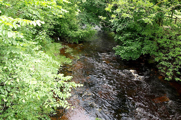 BQV13.jpg View of river. (taken 18.6.2009) |
||
|
|
||
 Lakes Guides menu.