 Old Cumbria Gazetteer
 |
 |
|
| Bela Falls, Beetham | ||
| Bela Falls | ||
| Beetham Force | ||
| site name:- | Bela, River | |
| locality:- | Beetham | |
| civil parish:- | Beetham (formerly Westmorland) | |
| county:- | Cumbria | |
| locality type:- | waterfall | |
| locality type:- | weir | |
| coordinates:- | SD49647996 (?) | |
| 1Km square:- | SD4979 | |
| 10Km square:- | SD47 | |
| SummaryText:- | The waterfall is now part of the weir for the mill pond for Heron Corn Mill. | |
|
|
||
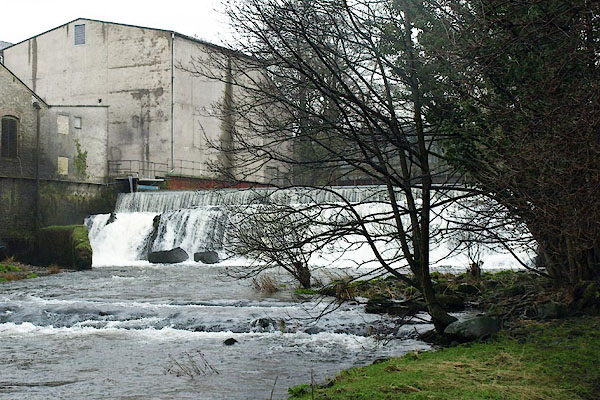 BPY89.jpg Weir on The Bela. (taken 30.1.2009) 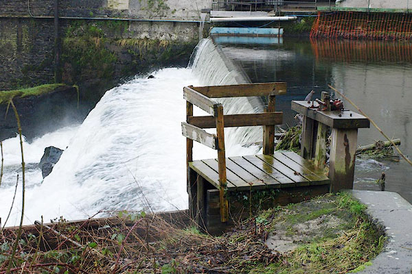 BPY85.jpg Sluice to the mill lade. (taken 30.1.2009) |
||
|
|
||
| evidence:- | descriptive text:- Keer 1605 (edn 1620) item:- catadupa |
|
| source data:- | Map, Westmorlandia et Comberlandia, ie Westmorland and
Cumberland now Cumbria, scale about 16 miles to 1 inch, probably
by Pieter van den Keere, or Peter Keer, about 1605, published
about 1605 to 1676. goto source goto sourcefourth page "... There are also neere Kendale in the River Can, two Catadupa or Waterfals, where the waters descend with such a forcible downefall, that it compels a mightie noyse to be heard, which the neighbour Inhabitants make such use of, as they stand them in as good stead as Prognostications: for when that which standeth North from them soundeth more cleare, and with a louder eccho in their eares, they certainly looke for faire weather to follow: But when that on the South do the like, they expect foggy mists and showers of raine." |
|
|
|
||
| evidence:- | probably old map:- Morden 1695 (Wmd) placename:- Catadupa |
|
| source data:- | Map, hand coloured engraving, Westmorland, scale about 2.5 miles to 1 inch, by Robert
Morden, published by Abel Swale, the Unicorn, St Paul's Churchyard, Awnsham, and John
Churchill, the Black Swan, Paternoster Row, London, 1695.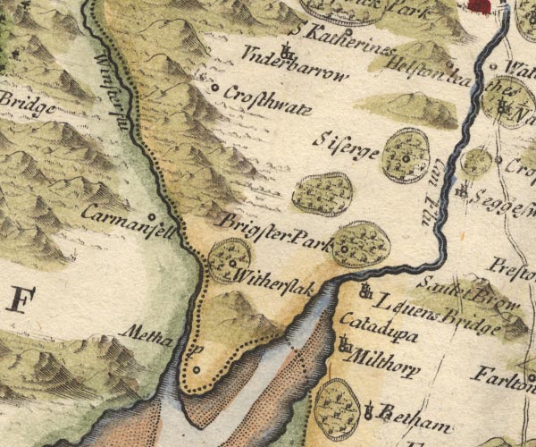 MD10SD48.jpg "Catadupa" No symbol. item:- JandMN : 24 Image © see bottom of page |
|
|
|
||
| evidence:- | probably old map:- Simpson 1746 map (Wmd) |
|
| source data:- | Map, uncoloured engraving, Westmorland, scale about 8 miles to 1
inch, printed by R Walker, Fleet Lane, London, 1746.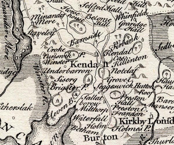 SMP2SDP.jpg "Waterfall" The label is downstream by the estuary. item:- Dove Cottage : 2007.38.59 Image © see bottom of page |
|
|
|
||
| evidence:- | old map:- Bowen and Kitchin 1760 |
|
| source data:- | Map, hand coloured engraving, A New Map of the Counties of
Cumberland and Westmoreland Divided into their Respective Wards,
scale about 4 miles to 1 inch, by Emanuel Bowen and Thomas
Kitchin et al, published by T Bowles, Robert Sayer, and John
Bowles, London, 1760.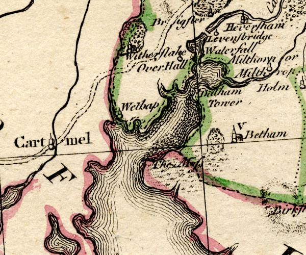 BO18SD37.jpg "Waterfall" no symbol, on the Ken below Levens Bridge item:- Armitt Library : 2008.14.10 Image © see bottom of page |
|
|
|
||
| evidence:- | old map:- Jefferys 1770 (Wmd) |
|
| source data:- | Map, 4 sheets, The County of Westmoreland, scale 1 inch to 1
mile, surveyed 1768, and engraved and published by Thomas
Jefferys, London, 1770.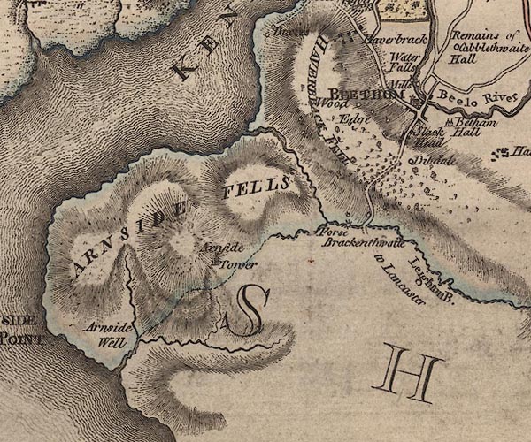 J5SD47NE.jpg "Water Falls" no symbol; waterfall item:- National Library of Scotland : EME.s.47 Image © National Library of Scotland |
|
|
|
||
| evidence:- | old text:- Camden 1789 item:- weather signs |
|
| source data:- | Book, Britannia, or A Chorographical Description of the Flourishing Kingdoms of England,
Scotland, and Ireland, by William Camden, 1586, translated from the 1607 Latin edition
by Richard Gough, published London, 1789. goto source Page 147:- "... Lower down [below Kendal] in the river Can are two falls, down which the water rushes with great noise, one at the little town of Levens, the other more to the south near Betham, which are certain prognostics of weather to the neighbourhood. For, when the northernmost makes a loud noise they expect fair weather, and when the southernmost does the same rain and fogs. ..." |
|
|
|
||
| evidence:- | old text:- Camden 1789 (Gough Additions) placename:- Betham Fall |
|
| source data:- | Book, Britannia, or A Chorographical Description of the Flourishing Kingdoms of England,
Scotland, and Ireland, by William Camden, 1586, translated from the 1607 Latin edition
by Richard Gough, published London, 1789. goto source Page 153:- "..." "In the river Betha is one of the two catadupae or waterfalls mentioned by Mr. Camden. The rock which crosses the bed of the river 66 feet in breadth is 16 feet perpendicular, down which the water falls with a mighty noise. But in the summer season the whole of the river is employed in carrying two corn mills." "The phaenomenon of Levens and Betham fall is thus to be explained. When that which is to the north sounds more loud and clear, the inhabitants look for sour weather; when that to the south, for rain; the south-west winds blowing from the sea bring the vapors with them, and from the north-east have the contrary effect." |
|
|
|
||
| evidence:- | old map:- Cary 1789 (edn 1805) |
|
| source data:- | Map, uncoloured engraving, Westmoreland, scale about 2.5 miles
to 1 inch, by John Cary, London, 1789; edition 1805.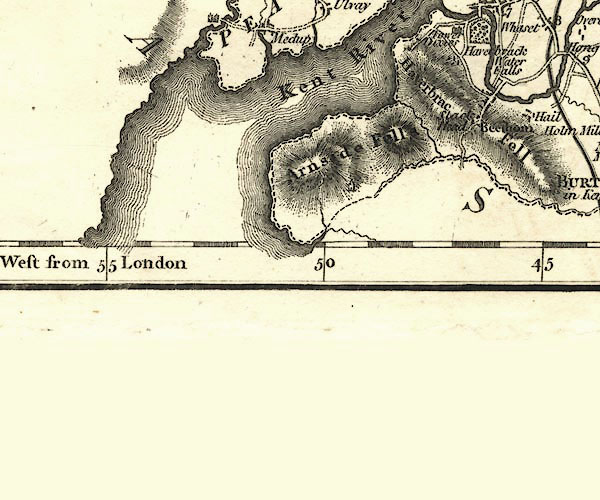 CY24SD47.jpg "Water Falls" on the Bela item:- JandMN : 129 Image © see bottom of page |
|
|
|
||
| see:- | waterfall, Levens |
|
|
|
||
Lakes Guides menu.