 Old Cumbria Gazetteer
 |
 |
|
| included in:- |
 St James, Hutton-in-the-Forest St James, Hutton-in-the-Forest |
|
| sundial, Hutton-in-the-Forest | ||
| site name:- | St James's Church | |
| locality:- | Hutton-in-the-Forest (?) | |
| civil parish:- | Skelton (formerly Cumberland) | |
| county:- | Cumbria | |
| locality type:- | sundial | |
| coordinates:- | NY45933644 | |
| 1Km square:- | NY4536 | |
| 10Km square:- | NY43 | |
|
|
||
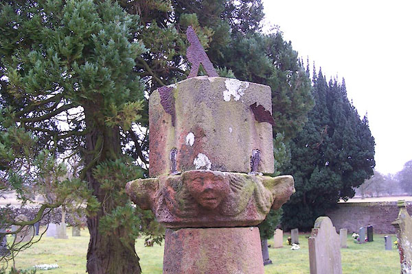 BLR04.jpg (taken 9.3.2006) 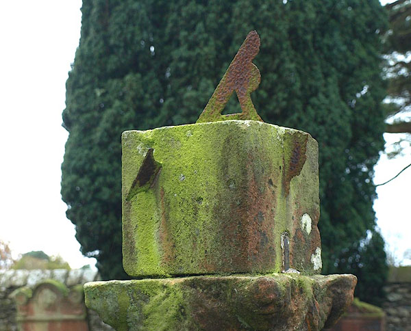 BPU63.jpg (taken 14.11.2008) |
||
|
|
||
| evidence:- | old map:- OS County Series (Cmd 49) |
|
| source data:- | Maps, County Series maps of Great Britain, scales 6 and 25
inches to 1 mile, published by the Ordnance Survey, Southampton,
Hampshire, from about 1863 to 1948. "Sundial" at St James's Church |
|
|
|
||
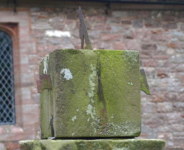 BPU64.jpg (taken 14.11.2008) 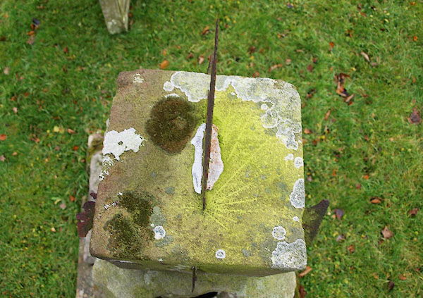 BPU65.jpg (taken 14.11.2008) |
||
|
|
||
| notes:- |
Cumbrian Sundials database, R Sylvester, 29.5.2008:- |
|
| "Hutton-in-the-Forest / Right of church path / Cube on pillar" |
||
| made 1700 |
||
| British Sundial Society reference number 222 |
||
|
|
||
Lakes Guides menu.