

item:- geology
 goto source
Page 158:- "The THIRD division - forming only inferior elevations - commences with a bed of dark-blue or blackish transition limestone, containing here and there a few shells and madrepores, and alternating with a slaty rock of the same colour; the different layers of each being in some places several feet, in others only a few inches in thickness. This limestone crosses the river Duddon near Broughton; passing Broughton Mills it runs in a north-east direction through Torver, by the foot of the Old Man mountain, and appears near Low Yewdale and Yew Tree. Here it makes a considerable slip to the eastward, after which it ranges past the Tarns upon the hills above Borwick Ground; and stretching through Skelwith, it crosses the head of Windermere near Low Wood Inn. Then passing above Dovenest and Skelgill, it traverses the vales of Troutbeck, Kentmere, and Long Sleddale;"
placename:- Skelgill
 goto source
Page 34:- "..."
"WANSFELL AND SKELGILL."
"Mountain excursions of moderate elevation, and almost without fatigue, may be made to Skelgill and Wansfell Pike, whence the localities of Ambleside are displayed as on a map, and thus the stranger is enabled to form a better idea of his position with regard to the mighty masses around him. Windermere, also, is seen in a new point of view."
placename:- Skelgill
 click to enlarge
PN0312.jpg
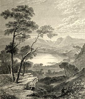
On p.25 of The Lakes in Sunshine, text by James Payn.
printed at bottom:- "HEAD OF WINDERMERE, FROM SKELGILL."
item:- Fell and Rock Climbing Club : 184.12
Image © see bottom of page
 click to enlarge
HB0309.jpg
item:- Armitt Library : ALPS668
Image © see bottom of page
