 Old Cumbria Gazetteer
 |
 |
|
| milestone, Lupton | ||
| site name:- | road, Kendal to Kirkby Lonsdale | |
| civil parish:- | Lupton (formerly Westmorland) | |
| county:- | Cumbria | |
| locality type:- | milestone | |
| coordinates:- | SD58678426 | |
| 1Km square:- | SD5884 | |
| 10Km square:- | SD58 | |
|
|
||
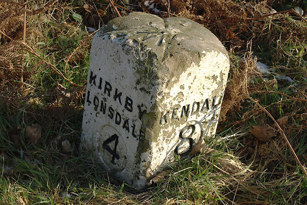 BPW46.jpg Inscribed stone:- "KIRKBY LONSDALE 4 / KENDAL 8" (taken 2.1.2009) 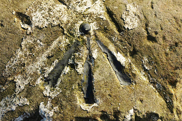 BPW47.jpg Rivet bench mark on top. (taken 2.1.2009) |
||
|
|
||
| evidence:- | old map:- OS County Series (Wmd 43 11) |
|
| source data:- | Maps, County Series maps of Great Britain, scales 6 and 25
inches to 1 mile, published by the Ordnance Survey, Southampton,
Hampshire, from about 1863 to 1948. "M.S. Kirkby Lonsdale.. 4 Kendal .. 8" |
|
|
|
||
| evidence:- | database:- Listed Buildings 2010 |
|
| source data:- | courtesy of English Heritage "MILESTONE AT SD 586 842 / / B6254 / LUPTON / SOUTH LAKELAND / CUMBRIA / II / 75706 / SD5866684264" |
|
| source data:- | courtesy of English Heritage "Milestone. Probably early C18. Dressed stone. Square on plan, set diagonally to road, each face has slightly rounded head. North side inscribed: "KIRKBY/LONSDALE/4"; south side inscribed: "KENDAL/8", probably recent. The numbers are in sunk ovals. Base not visible. Benchmark to top. Set on Kendal to Kirkby Lonsdale turnpike road, 1753." |
|
|
|
||
 Lakes Guides menu.