 Old Cumbria Gazetteer
 |
 |
|
| milestone, Upper Allithwaite (3) | ||
| site name:- | road, Kendal to Ulverston | |
| site name:- | road, Lancaster to Ulverston | |
| locality:- | High Newton | |
| civil parish:- | Upper Allithwaite (formerly Lancashire) | |
| county:- | Cumbria | |
| locality type:- | milestone | |
| coordinates:- | SD40348280 | |
| 1Km square:- | SD4082 | |
| 10Km square:- | SD48 | |
|
|
||
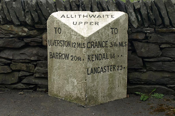 BPC38.jpg Inscribed stone:- "TO ULVERSTON 12 MLS BARROW 20¼, / ALLITHWAITE UPPER / TO GRANGE 3¾MLS KENDAL 14 ,, LANCASTER 25 ,[,]" (taken 26.4.2008) |
||
|
|
||
| evidence:- | old map:- OS County Series (Lan 12) |
|
| source data:- | Maps, County Series maps of Great Britain, scales 6 and 25
inches to 1 mile, published by the Ordnance Survey, Southampton,
Hampshire, from about 1863 to 1948. "M.S. ULVERSTON 11 MILNTHORPE 11" |
|
|
|
||
 Lakes Guides menu.