 Old Cumbria Gazetteer
 |
 |
|
| included in:- |
 geological walk, St Bees Head geological walk, St Bees Head |
|
| Fleswick Bay, St Bees Head | ||
| Fleswick Bay | ||
| site name:- | Irish Sea | |
| site name:- | St Bees Head | |
| civil parish:- | St Bees (formerly Cumberland) | |
| county:- | Cumbria | |
| locality type:- | bay | |
| locality type:- | beach | |
| locality type:- | coast | |
| locality type:- | geological site | |
| coordinates:- | NX94501330 | |
| 1Km square:- | NX9413 | |
| 10Km square:- | NX91 | |
|
|
||
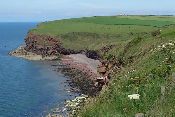 CDL18.jpg (taken 23.6.2015) 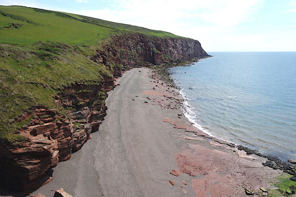 CDL29.jpg Beach and coast. (taken 23.6.2015) |
||
|
|
||
| evidence:- | old map:- OS County Series (Cmd 67 13) placename:- Fleswick |
|
| source data:- | Maps, County Series maps of Great Britain, scales 6 and 25
inches to 1 mile, published by the Ordnance Survey, Southampton,
Hampshire, from about 1863 to 1948. |
|
|
|
||
| evidence:- | old map:- Donald 1774 (Cmd) placename:- Fleswick |
|
| source data:- | Map, hand coloured engraving, 3x2 sheets, The County of Cumberland, scale about 1
inch to 1 mile, by Thomas Donald, engraved and published by Joseph Hodskinson, 29
Arundel Street, Strand, London, 1774.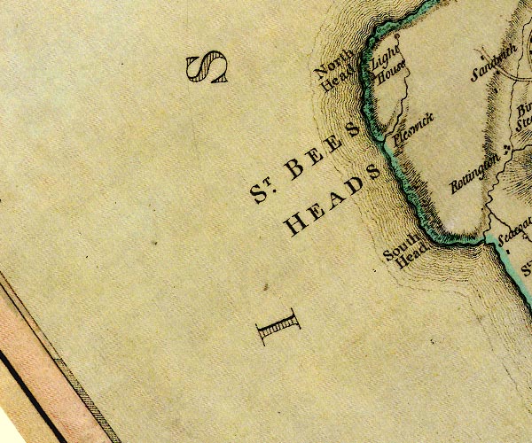 D4NX91SW.jpg "Fleswick" no symbol item:- Carlisle Library : Map 2 Image © Carlisle Library |
|
|
|
||
| evidence:- | old text:- Gents Mag placename:- Keswick Bay item:- geological site |
|
| source data:- | Magazine, The Gentleman's Magazine or Monthly Intelligencer or
Historical Chronicle, published by Edward Cave under the
pseudonym Sylvanus Urban, and by other publishers, London,
monthly from 1731 to 1922. goto source Gentleman's Magazine 1831 part 1 p.301 "[on St Bees Head] ... Passing Keswick Bay (where the lapidary may find pebbles of every hue, susceptible of a beautiful polish, and suitable for snuff-boxes, brooches, &c.), ..." |
|
|
|
||
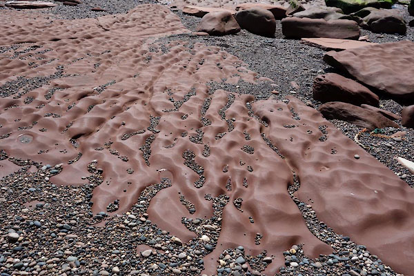 CDL22.jpg Ripple marks. (taken 23.6.2015) 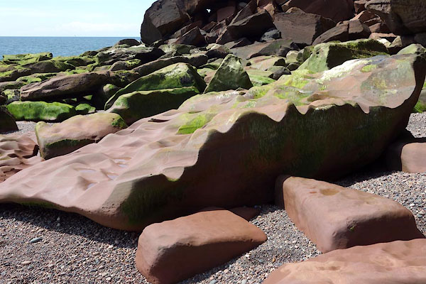 CDL23.jpg Ripple marks. (taken 23.6.2015) 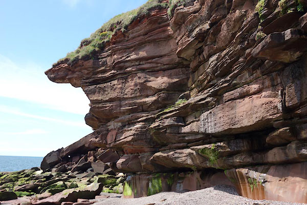 CDL24.jpg Jointed and eroded. (taken 23.6.2015) 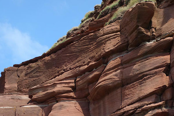 CDL25.jpg Notice the cross bedding. (taken 23.6.2015) 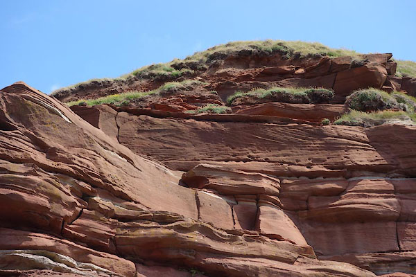 CDL26.jpg Notice the cross bedding. (taken 23.6.2015) 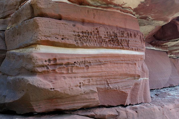 CDL27.jpg The sandstone is banded red and white; the red is coloured by iron as Fe2O3, the white by iron as FeO. (taken 23.6.2015) 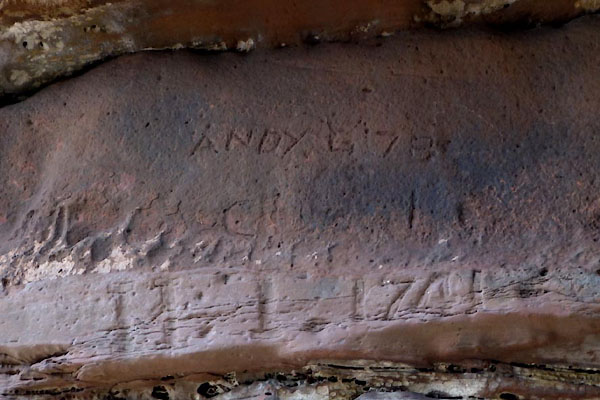 CDL28.jpg Graffiti:- "ANDY G 78" "H T 1741" (taken 23.6.2015) 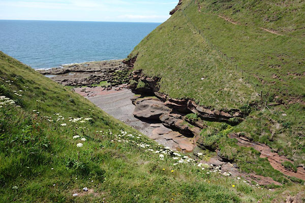 CDL20.jpg (taken 23.6.2015) 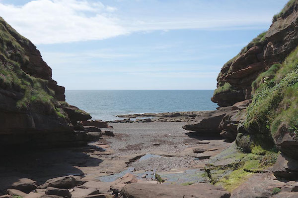 CDL21.jpg (taken 23.6.2015) |
||
| The approach gully is littered from the sea. |
||
|
|
||
Lakes Guides menu.