 Old Cumbria Gazetteer
 |
 |
|
| bridge, Bassenthwaite | ||
| site name:- | Halls Beck | |
| locality:- | Bassenthwaite | |
| civil parish:- | Bassenthwaite (formerly Cumberland) | |
| county:- | Cumbria | |
| locality type:- | bridge | |
| coordinates:- | NY23083235 | |
| 1Km square:- | NY2332 | |
| 10Km square:- | NY23 | |
|
|
||
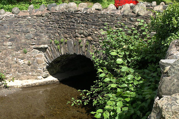 BVE36.jpg (taken 9.8.2011) |
||
|
|
||
| evidence:- | old map:- Bowen and Kitchin 1760 |
|
| source data:- | Map, hand coloured engraving, A New Map of the Counties of
Cumberland and Westmoreland Divided into their Respective Wards,
scale about 4 miles to 1 inch, by Emanuel Bowen and Thomas
Kitchin et al, published by T Bowles, Robert Sayer, and John
Bowles, London, 1760.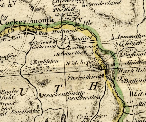 BO18NY12.jpg road across stream item:- Armitt Library : 2008.14.10 Image © see bottom of page |
|
|
|
||
| evidence:- | perhaps descriptive text:- Ford 1839 (3rd edn 1843) |
|
| source data:- | Guide book, A Description of Scenery in the Lake District, by
Rev William Ford, published by Charles Thurnam, Carlisle, by W
Edwards, 12 Ave Maria Lane, Charles Tilt, Fleet Street, William
Smith, 113 Fleet Street, London, by Currie and Bowman,
Newcastle, by Bancks and Co, Manchester, by Oliver and Boyd,
Edinburgh, and by Sinclair, Dumfries, 1839. goto source goto sourcePage 86:- "..." "... the Haws, a village watered by a stream called White Water Dash, and issuing from the north side of Skiddaw. The bridge is uncommonly pictu-" goto sourcePage 87:- "[pictu]resque, and indeed the artist may here enrich his portfolio with several choice studies. ..." |
|
|
|
||
Lakes Guides menu.