 Old Cumbria Gazetteer
 |
 |
|
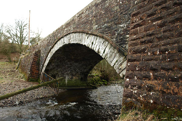
| Calley Bridge, Hutton | ||
| Calley Bridge | ||
| site name:- | Dacre Beck | |
| civil parish:- | Hutton (formerly Cumberland) | |
| civil parish:- | Dacre (formerly Cumberland) | |
| county:- | Cumbria | |
| locality type:- | bridge | |
| coordinates:- | NY43862652 | |
| 1Km square:- | NY4326 | |
| 10Km square:- | NY42 | |
|
|
||
 BQG37.jpg (taken 14.3.2009) 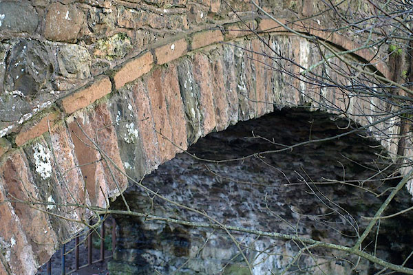 BOP15.jpg (taken 6.2.2008) |
||
|
|
||
| evidence:- | old map:- Bell 1892 placename:- Hutton John Bridge placename:- Calleywath Bridge |
|
| source data:- | Map, colour lithograph, Road Map of Cumberland, by George Joseph
Bell, scale about 2.5 miles to 1 inch, printed by Charles
Thurnam and Sons, Carlisle, Cumberland, 1892.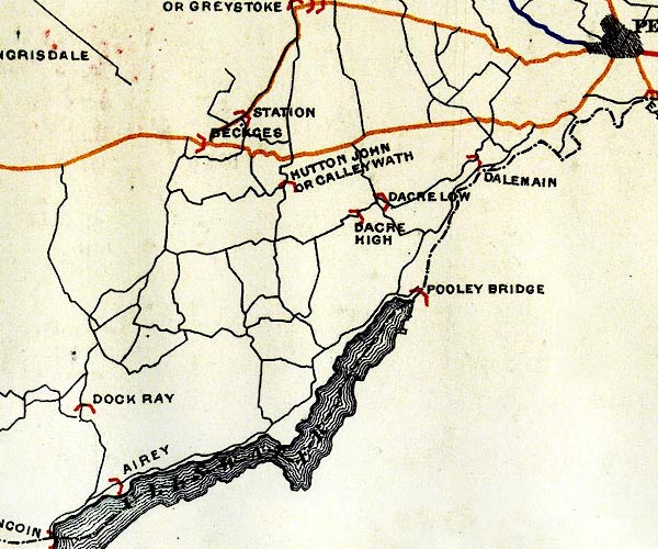 BEL9NY42.jpg "HUTTON JOHN OR CALLEYWATH" bridge symbol Road map of Cumberland showing County Bridges item:- Carlisle Library : Map 38 Image © Carlisle Library |
|
|
|
||
| evidence:- | database:- Listed Buildings 2010 placename:- Calley Bridge |
|
| source data:- | courtesy of English Heritage "CALLEY BRIDGE / / / MATTERDALE / EDEN / CUMBRIA / II / 74544 / NY4385926519" |
|
| source data:- | courtesy of English Heritage "Bridge over Dacre Beck. Inscribed: "I PARKER I TODD 1820". Dressed stone. Segmental arch with hood band. Straight parapet with chamfered coping, inscription to west parapet. Flanking raking abutments. Part of this item is in Dacre C.P." |
|
|
|
||
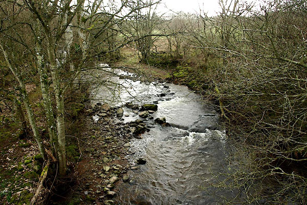 BQG38.jpg View of river. (taken 14.3.2009) 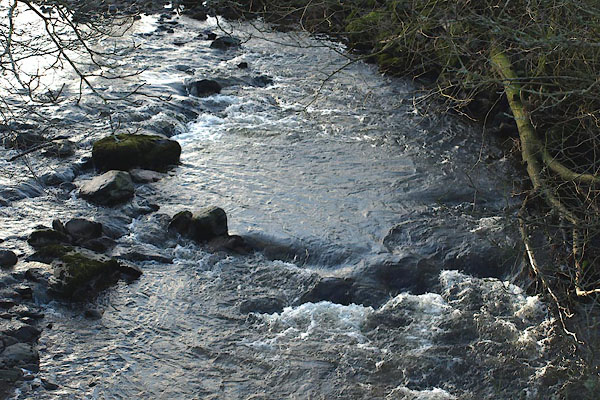 BOP16.jpg View of river. (taken 6.2.2008) |
||
|
|
||
 Lakes Guides menu.