 Old Cumbria Gazetteer
 |
 |
|
| Toll Bar Cottage, Casterton | ||
| Toll Bar Cottage | ||
| Gate House | ||
| site name:- | road, Kirkby Lonsdale to Sedbergh | |
| locality:- | High Casterton | |
| civil parish:- | Casterton (formerly Westmorland) | |
| county:- | Cumbria | |
| locality type:- | toll gate (site) | |
| locality type:- | toll house (ex) | |
| locality type:- | buildings | |
| coordinates:- | SD62137913 | |
| 1Km square:- | SD6279 | |
| 10Km square:- | SD67 | |
|
|
||
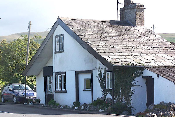 BOC59.jpg (taken 5.9.2007) |
||
|
|
||
| evidence:- | old map:- OS County Series (Wmd 47 8) placename:- Casterton Turn Pike |
|
| source data:- | Maps, County Series maps of Great Britain, scales 6 and 25
inches to 1 mile, published by the Ordnance Survey, Southampton,
Hampshire, from about 1863 to 1948. "Casterton T. P." line across road and building |
|
|
|
||
| evidence:- | database:- Listed Buildings 2010 placename:- Gatehouse |
|
| source data:- | courtesy of English Heritage "GATEHOUSE / / A683 / CASTERTON / SOUTH LAKELAND / CUMBRIA / II / 75609 / SD6213779130" |
|
|
|
||
 Lakes Guides menu.