 Old Cumbria Gazetteer
 |
 |
|
| St Margaret, Dalton-in-Furness | ||
| St Margaret's Church | ||
| locality:- | Dalton-in-Furness | |
| civil parish:- | Dalton Town with Newton (formerly Lancashire) | |
| county:- | Cumbria | |
| locality type:- | church | |
| coordinates:- | SD22407414 (??) | |
| 1Km square:- | SD2274 | |
| 10Km square:- | SD27 | |
| SummaryText:- | Sold to the catholic church. Some stained glass is now in S tMary's. | |
| references:- | Nurse 1918 |
|
|
|
||
| evidence:- | old map:- OS County Series (Lan 16 13) placename:- St Margaret's Church |
|
| source data:- | Maps, County Series maps of Great Britain, scales 6 and 25
inches to 1 mile, published by the Ordnance Survey, Southampton,
Hampshire, from about 1863 to 1948. "St. Margaret's Church / Church Yard" |
|
|
|
||
| evidence:- | old map:- Nurse 1918 |
|
| source data:- | Map, The Diocese of Carlisle, Cumberland, Westmorland, and
Lancashire North of the Sands, scale about 4 miles to 1 inch, by
Rev Euston J Nurse, published by Charles Thurnam and Sons, 11
English Street, Carlisle, Cumberland, 2nd edn 1939.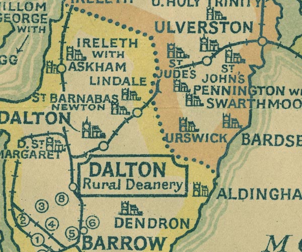 NUR1SD27.jpg "D. ST. MARGARET" item:- JandMN : 27 Image © see bottom of page |
|
|
|
||
 Lakes Guides menu.