 Old Cumbria Gazetteer
 |
 |
|
| milestone, Shap | ||
| site name:- | road, Shap to Penrith | |
| civil parish:- | Shap (formerly Westmorland) | |
| county:- | Cumbria | |
| locality type:- | milestone | |
| coordinates:- | NY56081627 | |
| 1Km square:- | NY5616 | |
| 10Km square:- | NY51 | |
| references:- | OS 2000s Explorer |
|
|
|
||
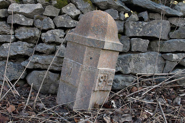 BSG20.jpg Cast iron:- "SHAP 1 MILE / 1825 / PENRITH 9½MILES" (taken 12.3.2010) 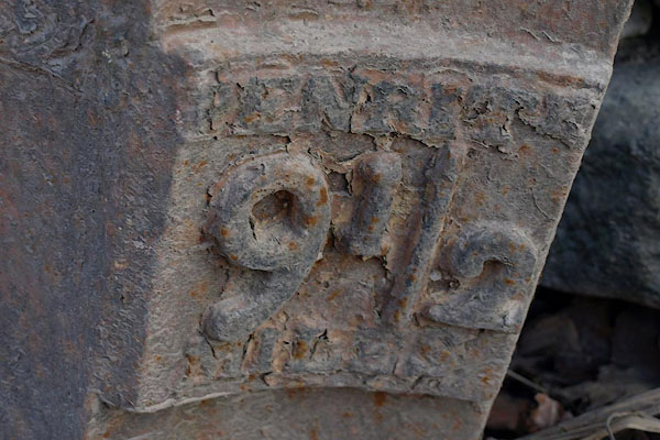 BSG21.jpg "PENRITH 9½MILES" (taken 12.3.2010) |
||
|
|
||
| evidence:- | old map:- OS County Series (Wmd 14 10) |
|
| source data:- | Maps, County Series maps of Great Britain, scales 6 and 25
inches to 1 mile, published by the Ordnance Survey, Southampton,
Hampshire, from about 1863 to 1948. "M.P. Penrith 9½ Shap 1" |
|
|
|
||
| evidence:- | database:- Listed Buildings 2010 |
|
| source data:- | courtesy of English Heritage "MILEPOST 350 YARDS SOUTH OF TURN TO SLEAGILL / / A6 / SHAP / EDEN / CUMBRIA / II / 74156 / NY5608916283" |
|
| source data:- | courtesy of English Heritage "Milepost, dated 1825, for Heron Syke Turnpike Trust. Oval foundry mark on top centre: T. WINDER GATEBECK FOUNDRY. Cast-iron c.3 ft high. 3 concave sides with ogee domical top. Separate plates giving town names and distances in raised letters are fastened to sides of main casting. Left: SHAP 1 MILE. Date to centre. Right: PENRITH 9 1/2 MILES. Painted white with lettering, foundry mark, and top edges picked out in black." |
|
|
|
||
 Lakes Guides menu.