 Old Cumbria Gazetteer
 |
 |
|
| Kirkby Thore Bridge, Kirkby Thore | ||
| Kirkby Thore Bridge | ||
| site name:- | Trout Beck (4) | |
| locality:- | Kirkby Thore | |
| civil parish:- | Kirkby Thore (formerly Westmorland) | |
| civil parish:- | Crackenthorpe (formerly Westmorland) | |
| county:- | Cumbria | |
| locality type:- | bridge | |
| coordinates:- | NY63542530 | |
| 1Km square:- | NY6325 | |
| 10Km square:- | NY62 | |
|
|
||
| evidence:- | old map:- OS County Series (Wmd 9 1) placename:- Kirkbythore Bridge |
|
| source data:- | Maps, County Series maps of Great Britain, scales 6 and 25
inches to 1 mile, published by the Ordnance Survey, Southampton,
Hampshire, from about 1863 to 1948. |
|
|
|
||
| evidence:- | old map:- Morden 1695 (Wmd) |
|
| source data:- | Map, hand coloured engraving, Westmorland, scale about 2.5 miles to 1 inch, by Robert
Morden, published by Abel Swale, the Unicorn, St Paul's Churchyard, Awnsham, and John
Churchill, the Black Swan, Paternoster Row, London, 1695.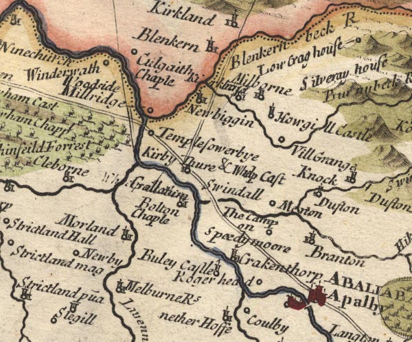 MD10NY62.jpg Note that the river is the Trout Beck, the Swindale Beck is a headwater. item:- JandMN : 24 Image © see bottom of page |
|
|
|
||
| evidence:- | old map:- Simpson 1746 map (Wmd) |
|
| source data:- | Map, uncoloured engraving, Westmorland, scale about 8 miles to 1
inch, printed by R Walker, Fleet Lane, London, 1746.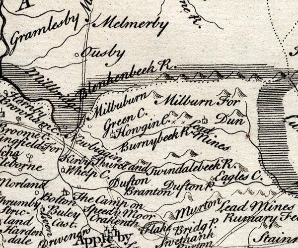 SMP2NYR.jpg Bridge; without its road which is drawn elsewhere. item:- Dove Cottage : 2007.38.59 Image © see bottom of page |
|
|
|
||
| evidence:- | probably old map:- Bowen and Kitchin 1760 |
|
| source data:- | Map, hand coloured engraving, A New Map of the Counties of
Cumberland and Westmoreland Divided into their Respective Wards,
scale about 4 miles to 1 inch, by Emanuel Bowen and Thomas
Kitchin et al, published by T Bowles, Robert Sayer, and John
Bowles, London, 1760.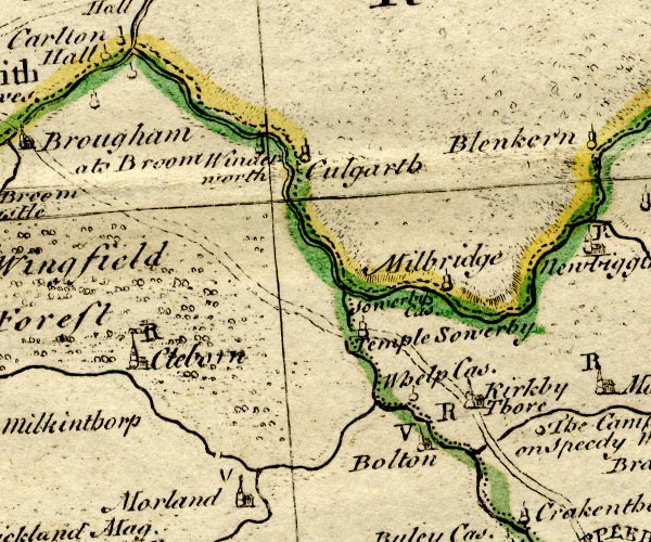 BO18NY52.jpg road across the Trout Beck item:- Armitt Library : 2008.14.10 Image © see bottom of page |
|
|
|
||
| evidence:- | old map:- Jefferys 1770 (Wmd) |
|
| source data:- | Map, 4 sheets, The County of Westmoreland, scale 1 inch to 1
mile, surveyed 1768, and engraved and published by Thomas
Jefferys, London, 1770. J5NY62SW.jpg double line, road, across a stream; bridge item:- National Library of Scotland : EME.s.47 Image © National Library of Scotland |
|
|
|
||
| evidence:- | old map:- Cary 1789 (edn 1805) |
|
| source data:- | Map, uncoloured engraving, Westmoreland, scale about 2.5 miles
to 1 inch, by John Cary, London, 1789; edition 1805.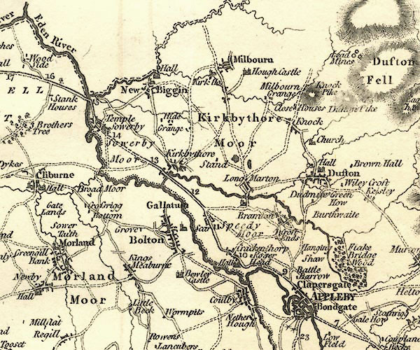 CY24NY62.jpg bridge over the Eden item:- JandMN : 129 Image © see bottom of page |
|
|
|
||
| evidence:- | old text:- Gents Mag item:- finds |
|
| source data:- | Magazine, The Gentleman's Magazine or Monthly Intelligencer or
Historical Chronicle, published by Edward Cave under the
pseudonym Sylvanus Urban, and by other publishers, London,
monthly from 1731 to 1922. goto source goto sourceGentleman's Magazine 1858 part 1 p.68 At a meeting of the Society of Antiquaries. "December 10. ..." "... ..." "SIR GEORGE MUSGRAVE, Bart., exhibited, through Mr. W. A. Franks, a collection of Roman remains, found chiefly in the county of Westmoreland. They consist of several objects discovered at Kirkby Thore, on the river Troutbeck, on making the foundations of a new bridge, in the year 1838, - comprising a bronze ligula, five bow-shaped fibulae, and four ring-shaped fibulae. Also four bow-shaped Roman and two enamelled fibulae, one of them crescent-shaped, the other in the form of a cock - and the upper ornament and the chape or lower end of a scabbard of Romano-Celtic workmanship. With these was included a very fine gold Roman ring found near Thursby, in Cumberland, in the year 1836. This interesting collection is destined by the liberal owner as a present to the British Museum." "... ..." |
|
|
|
||
| evidence:- | old text:- Gents Mag 1858 item:- roman finds |
|
| source data:- | goto source Gentleman's Magazine 1858 part 1 p.188 Archaeological Institute? "... ..." "... Mr. Franks exhibited an extensive assemblage of Roman reliques from Kirkby Thore, Westmoreland, which have subsequently been presented to the British Museum by the liberality of Sir G. Musgrave, Bart." |
|
|
|
||
Lakes Guides menu.