Old Cumbria Gazetteer
 |
 |
|
||
| Branthwaite Beck | ||||
| runs into:- |  Parkend Beck Parkend Beck |
|||
|
|
||||
| Dale Beck | ||||
| locality:- | Branthwaite | |||
| civil parish:- | Caldbeck (formerly Cumberland) | |||
| county:- | Cumbria | |||
| locality type:- | river | |||
| 1Km square:- | NY2937 | |||
| 10Km square:- | NY23 | |||
| SummaryText:- | a strtech above Branthwaite is called Dale Beck | |||
|
|
||||
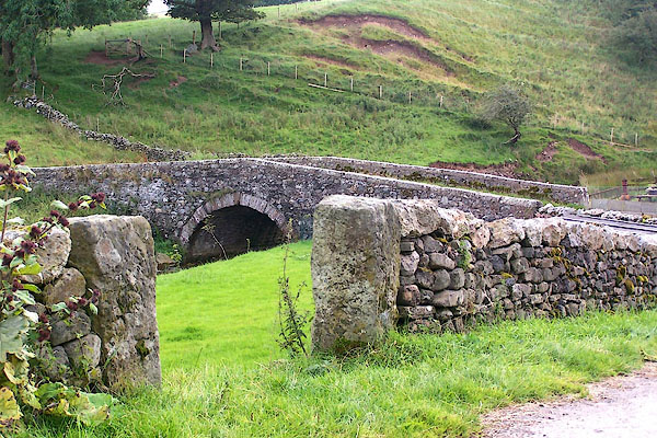
 BNY24.jpg At Branthwaite Bridge. (taken 15.8.2007) |
||||
|
|
||||
| evidence:- | old map:- OS County Series (Cmd 47 3) placename:- Branthwaite Beck |
|||
| source data:- | Maps, County Series maps of Great Britain, scales 6 and 25
inches to 1 mile, published by the Ordnance Survey, Southampton,
Hampshire, from about 1863 to 1948. |
|||
|
|
||||
| places:- |
|
|||
Lakes Guides menu.