 Old Cumbria Gazetteer
 |
 |
|
| boundary stone, Askham/Bampton/etc | ||
| site name:- | Loadpot Hill | |
| civil parish:- | Askham (formerly Westmorland) | |
| civil parish:- | Bampton (formerly Westmorland) | |
| civil parish:- | Barton (formerly Westmorland) | |
| county:- | Cumbria | |
| locality type:- | boundary stone | |
| locality type:- | parish boundary mark | |
| coordinates:- | NY45721808 | |
| 1Km square:- | NY4518 | |
| 10Km square:- | NY41 | |
|
|
||
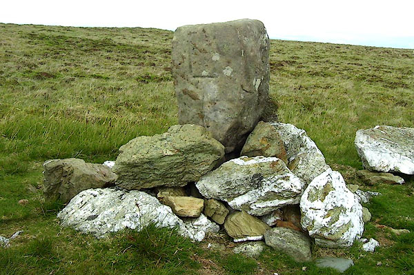 BNX17.jpg Inscribed:- "L" perhaps for Lowther (taken 30.7.2007) |
||
| This is perhaps an estate boundary rather than a parish boundary. |
||
|
|
||
 Lakes Guides menu.