 Old Cumbria Gazetteer
 |
 |
|
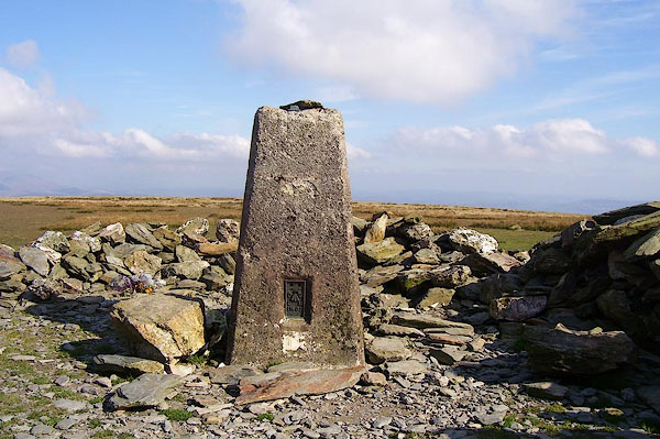
| trig point, SD1354985488 | ||
| site name:- | Black Combe | |
| civil parish:- | Whicham (formerly Cumberland) | |
| county:- | Cumbria | |
| locality type:- | trig point (pillar) | |
| coordinates:- | SD1354985488 | |
| 1Km square:- | SD1385 | |
| 10Km square:- | SD18 | |
| altitude:- | 1971 feet | |
| altitude:- | 600.7m | |
| references:- | OS website |
|
|
|
||
 BOF67.jpg (taken 1.10.2007) 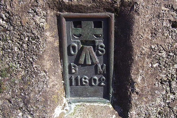 BOF68.jpg (taken 1.10.2007) 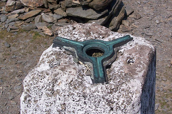 BWQ72.jpg (taken 27.5.2012) |
||
|
|
||
| evidence:- | descriptive text:- OS 1967 |
|
| source data:- | Book, the History of the Retriangulation of Great Britain
1935-1962, by the Ordnance Survey, published by HMSO, London,
1967. Position, NGR coordinates, metres (to nearest mm):- "313 549.149 / 485 488.093" Position, latitude and longitude, degrees minutes decimal seconds:- "54 15 27.3224 / 03 19 28.0451 W" |
|
|
|
||
| :- |
This was a primary triangulation station. |
|
| James, Henry: 1875: Account of the Methods and Processes ... the Ordnance Survey:
HMSO (London) |
||
|
|
||
 Lakes Guides menu.