 Old Cumbria Gazetteer
 |
 |
|
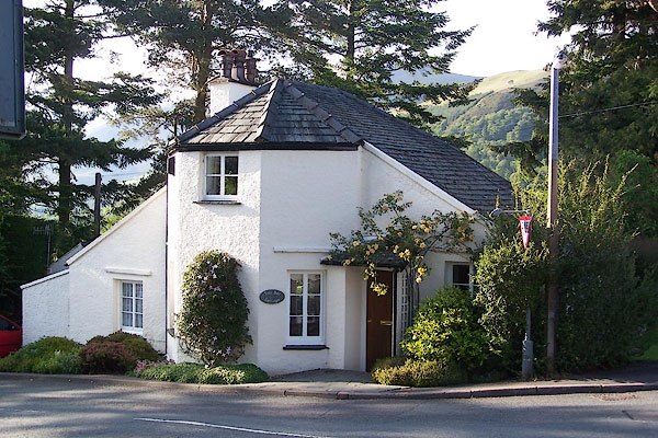
| Toll Bar Cottage, Keswick (2) | ||
| Tollbar Cottage | ||
| site name:- | road, Ambleside to Keswick | |
| locality:- | Castlerigg | |
| civil parish:- | Keswick (formerly Cumberland) | |
| county:- | Cumbria | |
| locality type:- | buildings | |
| locality type:- | toll gate (site) | |
| locality type:- | toll house (ex) | |
| coordinates:- | NY27822323 | |
| 1Km square:- | NY2723 | |
| 10Km square:- | NY22 | |
|
|
||
 BNS67.jpg (taken 25.5.2007) |
||
|
|
||
| evidence:- | old map:- Clarke 1787 map (Der) |
|
| source data:- | Map, uncoloured engraving, Map of Derwentwater and its Environs,
scale about 13 ins to 1 mile, by James Clarke, engraved by S J
Neele, published by James Clarke, Penrith, Cumberland and in
London etc, 1787.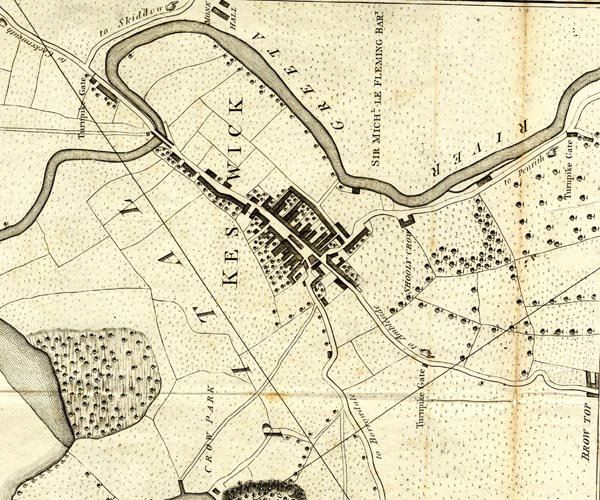 CL152623.jpg "Turnpike Gate" toll house, but no line across the road to Ambleside item:- private collection : 169 Image © see bottom of page |
|
|
|
||
| evidence:- | probably old directory:- Jollie 1811 placename:- Brow Top Tollgate |
|
| source data:- | Guide book, Jollie's Cumberland Guide and Directory, published
by Francis Jollie and Sons, Carlisle, Cumberland, 1811. "Scott, John, Brow-top toll-gate" |
|
|
|
||
| evidence:- | old itinerary:- Johnson 1908 (Roads/Cum) |
|
| source data:- | Itinerary, Route 42 in Roads Made Easy by Picture and Pen, Kendal to Carlisle, through
The Lakes, by Claude Johnson, edited by Lord Montagu, published by The Car Illustrated,
168 Piccadilly, London, 1908.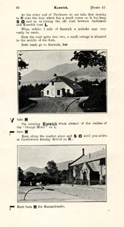 click to enlarge click to enlargeJS5086.jpg item:- private collection : 268.12 Image © see bottom of page |
|
|
|
||
| evidence:- | old map:- Burrow 1920s |
|
| source data:- | Road book, On the Road, Dunlop Pictorial Road Plans, volume V,
strip maps with parts in Westmorland, Cumberland etc, irregular
scale about 1.5 miles to 1 inch, by E J Burrow and Co,
Cheltenham, Gloucestershire, 1920s.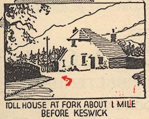 EJB3Vg42.jpg item:- private collection : 17 Image © see bottom of page |
|
|
|
||
 Lakes Guides menu.