


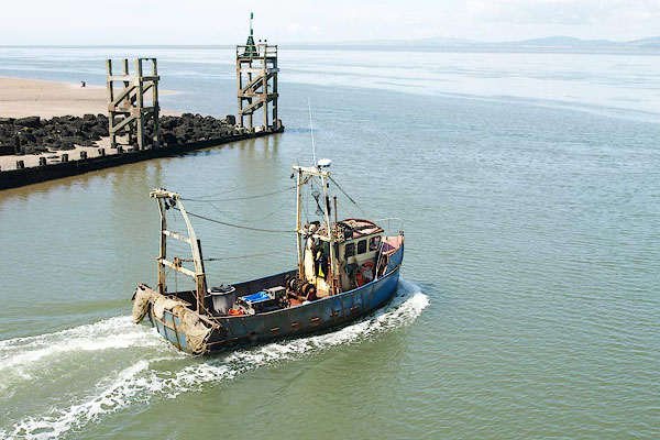
BRA90.jpg A fishing boat leaving.
(taken 10.7.2009)
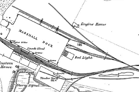
placename:- Marshall Dock
item:- goods shed; crane
 click to enlarge
CSRY0024.jpg
"MARSHALL DOCK"
item:- ship; coal drop (?)
WD0124.jpg
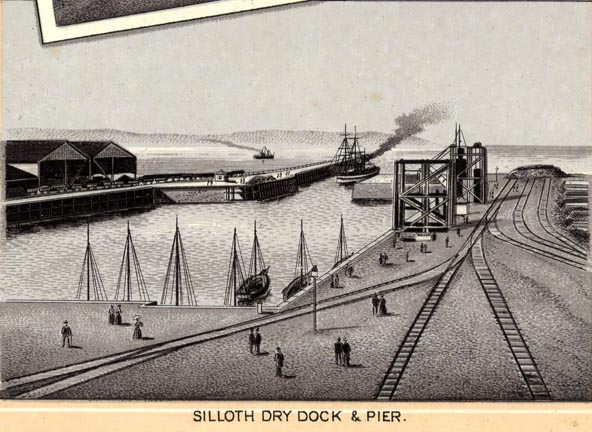
Included in a Souvenir Album of Silloth.
printed at bottom:- "SILLOTH DRY DOCK &PIER."
item:- JandMN : 454.24
Image © see bottom of page
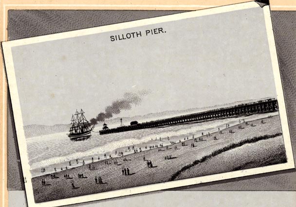
placename:- Silloth Pier
item:- ship
WD0123.jpg
Included in a Souvenir Album of Silloth.
printed at upper centre:- "SILLOTH PIER."
item:- JandMN : 454.23
Image © see bottom of page
placename:- Silloth Wet Dock
item:- ship; clipper
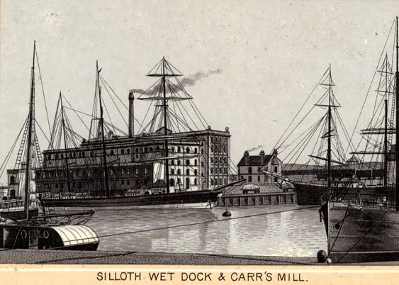
WD0122.jpg
Included in a Souvenir Album of Silloth.
printed at bottom:- "SILLOTH WET DOCK &CARR'S MILL"
item:- JandMN : 454.22
Image © see bottom of page
placename:-
item:- pilot, Port of Silloth; tide gauge, Silloth; navigation lights; buoy, Solway Channel; coal; water; railways
 goto source
Page 387:- "..."
"FIRTH OF SOLWAY. - ..."
"Whitehaven, Workington, Maryport and Silloth, all on the English shore, are the chief trading ports in the firth."
 goto source
Page 388:- "..."
"Trinity House pilots for Silloth and Annan can be obtained at Maryport, on application to the Harbour Master at Silloth, or the pilots at Silloth or Annan."
 goto source
Page 398:- "..."
"SILLOTH. - Dangers in the approach. - Dubmill scar, Far Sand bank, and Ellison scar extend nearly 3 miles westward from Dubmill point and form a continuous line of shoals, which obstruct the approach to Silloth from the south-westward. The coast between Dubmill point and Silloth is fronted, to a distance of from 1 3/4 to a quarter of a mile, by the Beckfoot flats, which dry and on which are a number of scars. Catherinehole scar, which dries about 8 feet (2m4), lies near the outer edge of these flats, about midway between Ellison scar and Lees scar, at the northern end."
"On the north-western side of the approach is the continuation north-eastward of Robin Rigg, formerly known as North bank, with Silloth bank close south-eastward of it; these banks are not"
 goto source
Page 399:- "charted, as before stated, on account of the rapid changes that take place in them."
"Channel. - Depths. - Anchorage. - The least charted depth in Silloth channel is 9 feet (2m7), over the bar northward of Ellison scar. North-eastward of the bar, between it and Silloth docks, there are depths of from 4 to 6 fathoms (7m5 to 11m0), sand and clay, in Catherinehole, where temporary anchorage may be obtained, sheltered from all winds by sandbanks which dry at about half ebb. As stated before, these depths are subject to change."
"Lights. - Fog signals. - A light is exhibited, at an elevation of 33 feet (10m1), from a white structure on piles, 45 feet (13m7) in height, situated on Lees scar, about 6 cables south-westward of Silloth pierhead (Lat. 54~ 52' N., long. 3~ 24' W.). A fog signal is sounded from the structure during tide time."
"A light, known as Cote or Skinburness light, is exhibited, at an elevation of 50 feet (15m2), from a white structure on piles, 32 feet (9m8) in height, situated near the coast, about one mile north-north-eastward of Silloth and bearing 048~ from Lees Scar light. In 1932, these lights in line did not lead through the deepest part of the channel over the bar."
"A light is exhibited, at an elevation of 33 feet (10m1), from a white tower, 26 feet (7m9) in height, situated at the head of Silloth pier. A fog signal is sounded from the pierhead during tide-time."
"Tide gauge. - A tide gauge, which indicates in large figures, the depth in the entrance to the dock, is attached to Lees Scar light-structure."
"Buoys - a red conical light-buoy, marked "S.O.", which exhibits a white group flashing light, having two flashes every fifteen seconds, is moored near the 3-fathom (5m5) line, about 3 3/4 miles south-westward of Dubmill point."
"A black can buoy, marked "S.1.", is moored near the 5-fathom (9m1) line forming the south-eastern edge of Robin Rigg, about 4 3/4 miles west-south-westward of Dubmill point."
"A red conical buoy, marked "S.1.", is moored on the eastern side of the channel, about 3 1/4 miles south-westward of Dubmill point."
"A red light-and-bell-buoy, marked "Solway", which exhibits a white flashing light every ten seconds, is moored about 4 miles west-south-westward of Dubmill point."
"The starboard side of the channel, north-eastward of Solway buoy, is marked by red conical buoys, marked from "S.2" to "S.5". These buoys are shifted as necessary to meet the changes in the channel."
"Tidal streams. - See table of tidal streams for the position lat. 54~ 47 3/4 N., long. 3~ 31 3/4 W. on chart 1346."
"The tidal streams run at a rate of about 4 knots through Catherinehole at springs."
"Harbour. - The harbour (Lat. 54~ 52' N., Long. 3~ 24' W.) consists of a tidal basin, which was, originally, Marshall dock, and Silloth wet dock, with an area of about 6 acres and about 2,000 feet (609m6) of quayage."
"Silloth wet dock is entered from the tidal basin through a lock, 125 feet (38m1) long, and 57 feet (17m4) wide, with depths of 24 feet (7m3) over the sill at high-water springs."
 goto source
Page 400:- "There are depths of 24 feet (7m3) in the dock at high water springs, and depths of from 16 to 17 feet (4m9 to 5m2) are normally maintained in the dock. The lock gates are open, for direct entry into the dock, from 1 1/2 hours before until high water."
"A wooden jetty extends about 1 3/4 cables north-westward from the southern side of the entrance to the tidal basin towards the low-water line. A large-linked chain is laid along the north-eastern side of the entrance, parallel with this jetty, for the purpose of bringing up vessels obliged to anchor in the channel; it is marked at intervals by warping buoys."
"Docking signals. - A red ball, shown from the signal mast on the root of the jetty, by day, or a green fixed light at night, indicates that the lock gates are open."
"Two lights exhibited at the head of the dock, kept in line, lead through the centre of the dock entrance."
"Two red balls, shown from the signal mast, by day, or a green light over a red light, at night, signify that the gates are closed, or that the approach to the dock is obstructed, and no vessel should then attempt to enter."
"Pilots. - Tugs. - Pilots can be obtained off Maryport. See also page 388."
"The services of a tug are usually obtainable."
"Port facilities. - Coal can be obtained from local collieries, and can be put on board rapidly by means of an hydraulic hoist."
"Water is laid on at the quays."
"The dock is equipped with every appliance for the rapid discharge and loading of vessels; there is a 25-ton crane and nine 2-ton hydraulic cranes; there are sheds for the storage of goods; and the quays are connected by rail to the mainline railway system."
"For Customs purposes Silloth is a creek of Carlisle, with which place it is connected by railway direct."
"There is steamer communication twice weekly with the Isle of Man and with Dublin."
"Shipping. - During 1932, a total of 289 vessels with an aggregate tonnage of 168,416 tons visited the port; of these, 3 were from foreign and colonial ports, and the remainder coastwise."
"Annan channel. - Pilots. - The passage to Annan from Silloth (Lat. 54~ 52' N., Long. 3~ 24' W.) is not available without local knowledge, owing to the rapidity of the tides and the shifting nature of the banks forming the channel, which has entirely altered several times within the last half century. It is well buoyed and is available for vessels of light draught, with a good pilot, but any attempt at description of directions would be useless and misleading."
"For information regarding pilots, see page 388."
"A tug is available at Silloth, by arrangement, to take vessels to or from Annan or Dumfries."
"..."
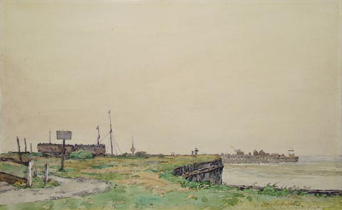
placename:- Pier, The
 click to enlarge
PR1052.jpg
Flat grassland above foreshore at Silloth with pier standing in the background. The scene is deserted except for four lightly sketched figures.
signed at bottom right:- "Jas Atherton"
labelled at reverse on mount:- "The Pier Silloth. Jas Atherton 4.4.0"
item:- Tullie House Museum : 1970.33.36
Image © Tullie House Museum
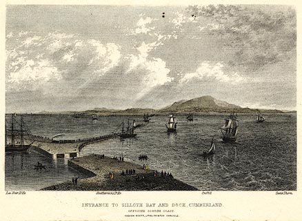
placename:- Silloth Dock
 click to enlarge
PR0369.jpg
There is shipping in the offing and at the dock, a train leaving the quay; some scottish coastal features are labelled - Lee Scar lighthouse, Southerness lighthouse, Criffel and Carse Thorn.
printed at bottom:- "ENTRANCE TO SILLOTH BAY AND DOCK, CUMBERLAND. / OPPOSITE THE SCOTCH COAST / HUDSON SCOTT, LITHO PRINTER CARLISLE."
item:- Dove Cottage : 2008.107.369
Image © see bottom of page
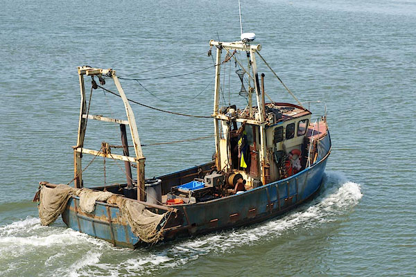
BRA91.jpg A fishing boat leaving.
(taken 10.7.2009)
