 Old Cumbria Gazetteer
 |
 |
|
| milestone, Westward | ||
| site name:- | road, Cockermouth to Carlisle | |
| civil parish:- | Westward (formerly Cumberland) | |
| county:- | Cumbria | |
| locality type:- | milestone | |
| coordinates:- | NY24854535 | |
| 1Km square:- | NY2445 | |
| 10Km square:- | NY24 | |
|
|
||
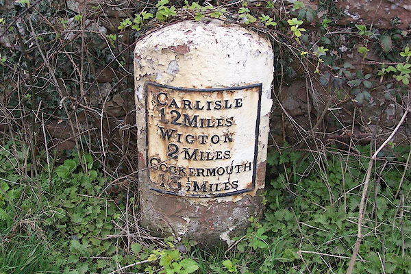 BNO38.jpg Cast iron plate on a stone:- "CARLISLE 12 WIGTON 2 COCKERMOUTH 13½" (taken 11.4.2007) |
||
|
|
||
| evidence:- | old map:- OS County Series (Cmd 29 13) |
|
| source data:- | Maps, County Series maps of Great Britain, scales 6 and 25
inches to 1 mile, published by the Ordnance Survey, Southampton,
Hampshire, from about 1863 to 1948. "M.S Carlisle ... 13. Wigton ... 2. Cockermouth ... 13 1/2" |
|
|
|
||
 Lakes Guides menu.