 Old Cumbria Gazetteer
 |
 |
|
| Harrington Harbour, Harrington | ||
| Harrington Harbour | ||
| site name:- | Wyre, River | |
| locality:- | Harrington | |
| civil parish:- | Workington (formerly Cumberland) | |
| county:- | Cumbria | |
| locality type:- | harbour | |
| coordinates:- | NX98762527 (etc) | |
| 1Km square:- | NX9825 | |
| 10Km square:- | NX92 | |
|
|
||
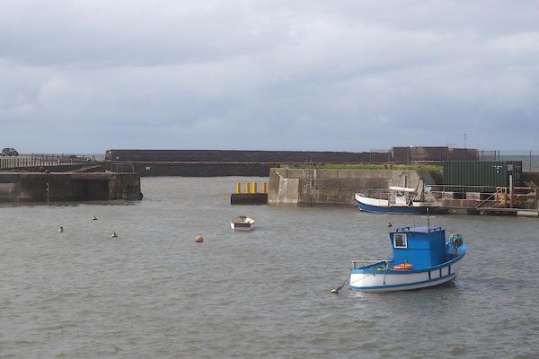 CFK78.jpg (taken 2.9.2016) 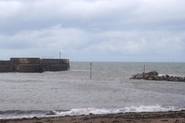 CFK80.jpg (taken 2.9.2016) |
||
|
|
||
| evidence:- | old map:- OS County Series (Cmd 61 3) |
|
| source data:- | Maps, County Series maps of Great Britain, scales 6 and 25
inches to 1 mile, published by the Ordnance Survey, Southampton,
Hampshire, from about 1863 to 1948. "Harbour" |
|
|
|
||
| evidence:- | old map:- Donald 1774 (Cmd) placename:- Bella Port |
|
| source data:- | Map, hand coloured engraving, 3x2 sheets, The County of Cumberland, scale about 1
inch to 1 mile, by Thomas Donald, engraved and published by Joseph Hodskinson, 29
Arundel Street, Strand, London, 1774.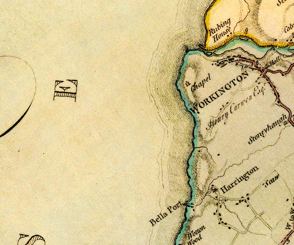 D4NX92NE.jpg "Bella Port" harbour mole; labelled in upright lowercase item:- Carlisle Library : Map 2 Image © Carlisle Library |
|
|
|
||
| evidence:- | old text:- Mackenzie 1776 placename:- Port Harrington |
|
| source data:- | Charts, and sailing directions, Nautical Descriptions of the
West Coast of Great Britain, Bristol Channel to Cape Wrath, by
Murdoch Mackenzie, published London, 1776. goto source goto sourcePages 23-24:- "... ..." "PORT-HARRINGTON." "Port Harrington lies about four miles northward (sic) of Whitehaven, and has twelve feet water in it at high-water with spring-tide, and seven or eight with neap-tide." |
|
|
|
||
| evidence:- | old map:- Ford 1839 map placename:- Harrington Harbour placename:- Bella Port |
|
| source data:- | Map, uncoloured engraving, Map of the Lake District of
Cumberland, Westmoreland and Lancashire, scale about 3.5 miles
to 1 inch, published by Charles Thurnam, Carlisle, and by R
Groombridge, 5 Paternoster Row, London, 3rd edn 1843.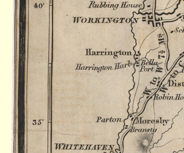 FD02NX92.jpg "Harrington Harb." "Bella Port" item:- JandMN : 100.1 Image © see bottom of page |
|
|
|
||
| evidence:- | old map:- Walker 1842 |
|
| source data:- | Chart, Position of all the Lighthouses in the British Isles,
scale about 38 nautical miles to 1 inch, published by J and A
Walker, 72 South Castle Street, Liverpool, Lancashire, 1842. marked with a harbour light "Harrington - A lantern is shewn whilst there is 8 feet depth in the Har." |
|
|
|
||
| evidence:- | old text:- Admiralty 1933 item:- ironworks, Harrington |
|
| source data:- | goto source Page 392:- "Harrington, which is prominently marked by some blast furnaces to the southward of it, has a small artificial harbour, now disused, formed by stone piers on the southern side and wooden breakwaters, on the northern side, through which a stream discharges." |
|
|
|
||
 old directory data with shipping old directory data with shipping |
||
|
|
||
| evidence:- | old print:- placename:- Harrington Harbour |
|
| source data:- | Print, uncoloured engraving, The Solway from Harrington Harbour, Cumberland, drawn
by W H Bartlett, engraved by R Brandard, published by George Virtue, 26 Ivy Lane,
London, 1841.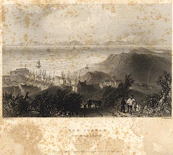 click to enlarge click to enlargePR0076.jpg Probably from Findens Views of the Ports, Harbours, Coast Scenery, and Watering Places of Great Britain, as continued by W H Bartlett. printed at bottom left, right, centre:- "W. H. Bartlett. / R. Brandard. / THE SOLWAY / (from Harrington Harbour.) / London: Published for the Proprietors, by Geo: Virtue, 26, Ivy Lane, 1841." item:- Dove Cottage : 2008.107.76 Image © see bottom of page |
|
|
|
||
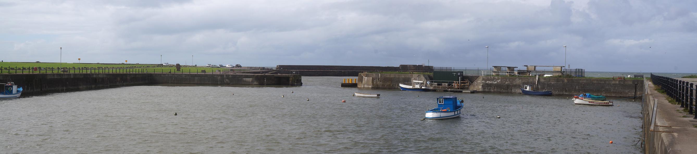 Click to enlarge CFK76.jpg (taken 2.9.2016) 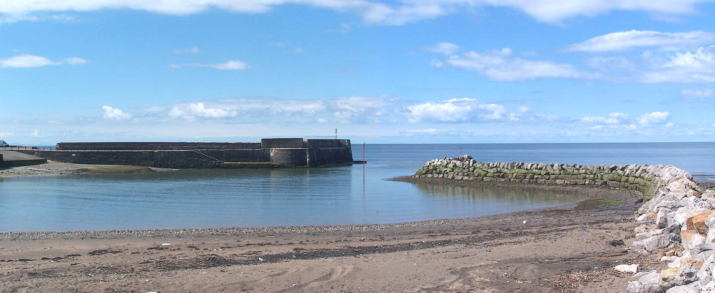 Click to enlarge BNQ34.jpg (taken 14.5.2007) 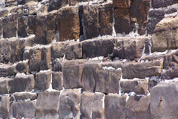 BNQ36.jpg Sandstone harbour wall. (taken 14.5.2007) 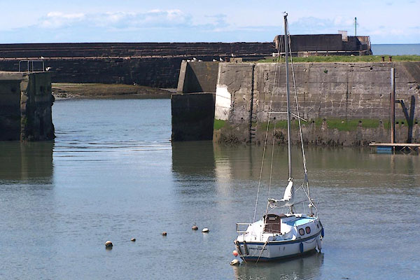 BNQ37.jpg Sailing boat. (taken 14.5.2007) 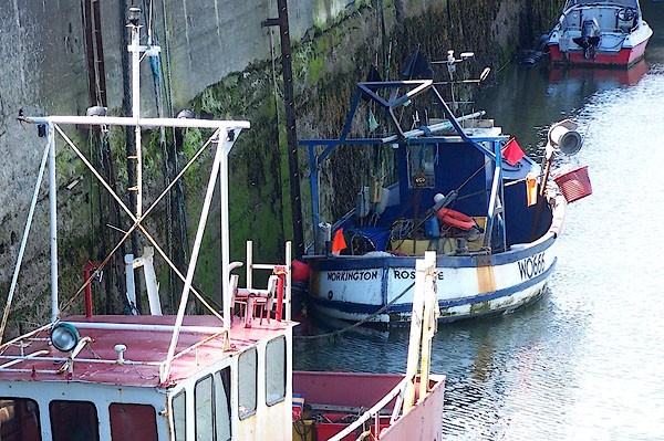 BNQ38.jpg Fishing boats. (taken 14.5.2007) 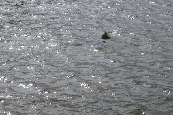 CFK79.jpg Mooring buoy. (taken 2.9.2016) 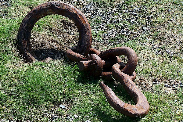 BNQ35.jpg Rusty iron. (taken 14.5.2007) 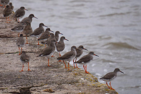 CFK87.jpg Redshank, Tringa totanus. (taken 2.9.2016) 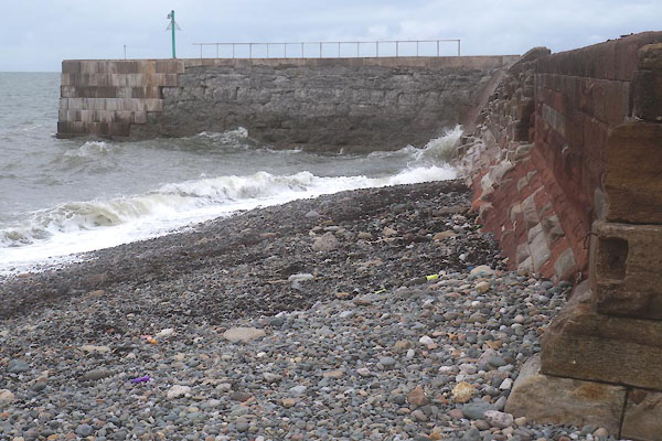 CFK90.jpg South Pier. (taken 2.9.2016) 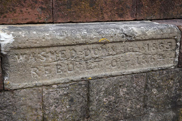 CFK93.jpg South Pier, plaque:- "WASHED DOWN [ ] 1863 / REBUILT OCT.1864" (taken 2.9.2016) 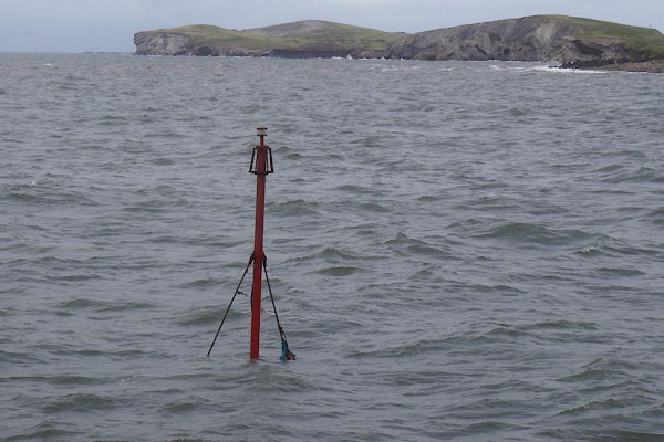 CFK91.jpg Northerly sea mark at harbour mouth (taken 2.9.2016) 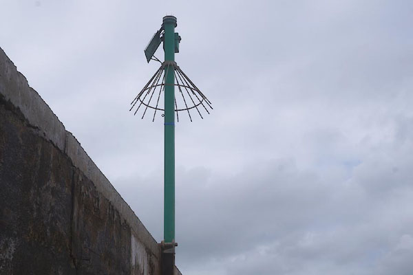 CFK92.jpg Southerly sea mark at harbour mouth, on South Pier (taken 2.9.2016) |
||
|
|
||
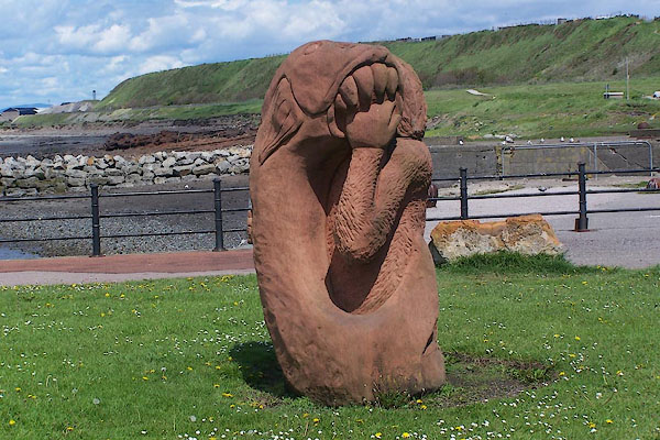 BNQ39.jpg Sandstone sculpture by the harbour. (taken 14.5.2007) 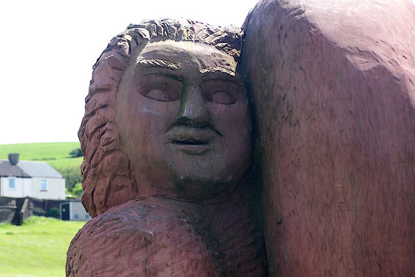 BNQ40.jpg Sandstone sculpture by the harbour. (taken 14.5.2007) |
||
|
|
||
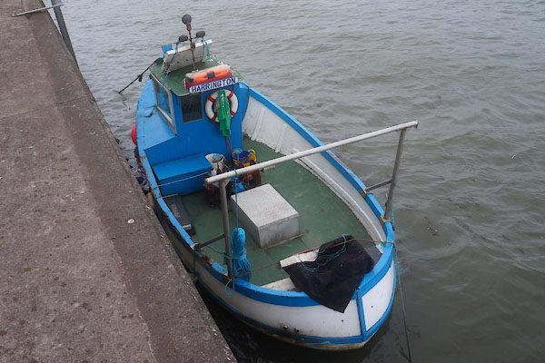 CFK83.jpg Fishing boat. (taken 2.9.2016) 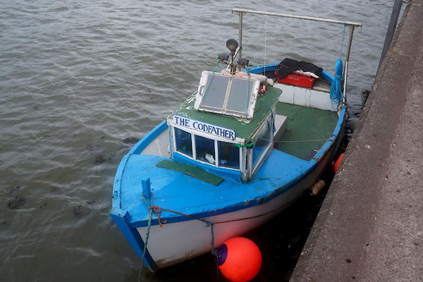 CFK84.jpg Fishing boat. (taken 2.9.2016) 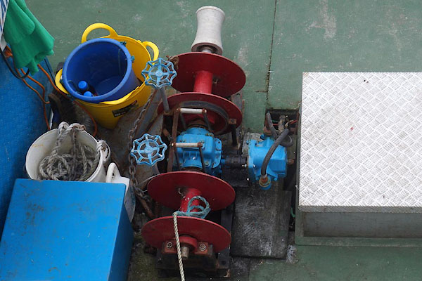 CFK85.jpg Fishing boat. (taken 2.9.2016) |
||
|
|
||
Lakes Guides menu.