 Old Cumbria Gazetteer
 |
 |
|
| boundary stone, Longsleddale/Shap Rural (12) | ||
| site name:- | Tarn Crag (roughly) | |
| locality:- | boundary, Longsleddale/Shap Rural | |
| civil parish:- | Longsleddale (formerly Westmorland) | |
| civil parish:- | Shap Rural (formerly Westmorland) | |
| county:- | Cumbria | |
| locality type:- | boundary stone | |
| locality type:- | parish boundary mark | |
| locality type:- | estate boundary mark | |
| coordinates:- | NY49100801 | |
| 1Km square:- | NY4908 | |
| 10Km square:- | NY40 | |
| SummaryText:- | The stone marks ownership, and the parish boundary incidentally. | |
|
|
||
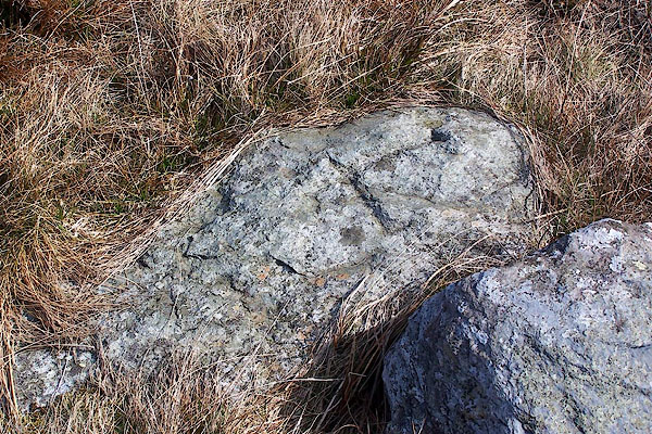 BNO64.jpg L for Lowther, the landowner in Shap Rural parish, to the north. (taken 12.4.2007) 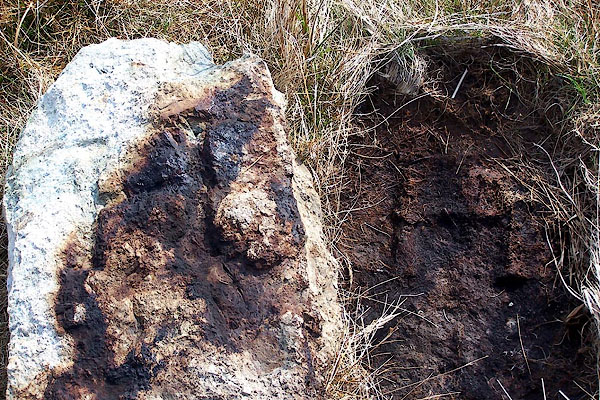 BNO65.jpg H for Harrison, the landowner in Longsleddale parish, to the south; having been half buried the letter H is impressed in the peat. (taken 12.4.2007) |
||
|
|
||
| evidence:- | map:- OS Six Inch (1956) |
|
| source data:- | Map series, various editions with the national grid, scale about
6 inches to 1 mile, published by the Ordnance Survey,
Southampton, Hampshire, scale 1 to 10560 from 1950s to 1960s,
then 1 to 10000 from 1960s to 2000s, superseded by print on
demand from digital data.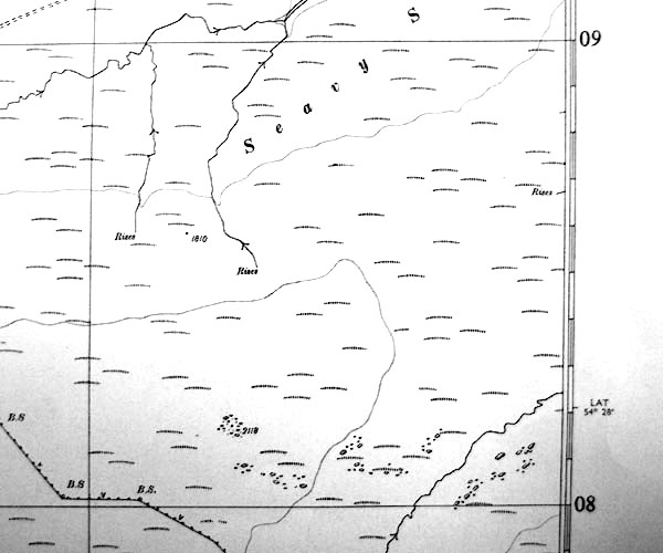 SINY4908.jpg "B.S." |
|
|
|
||
 Lakes Guides menu.