 Old Cumbria Gazetteer
 |
 |
|
| boundary stone, Longsleddale/Shap Rural (2) | ||
| site name:- | Harter Fell | |
| locality:- | boundary, Longsleddale/Shap Rural | |
| civil parish:- | Longsleddale (formerly Westmorland) | |
| civil parish:- | Shap Rural (formerly Westmorland) | |
| county:- | Cumbria | |
| locality type:- | boundary stone | |
| locality type:- | parish boundary mark | |
| coordinates:- | NY4647809717 | |
| 1Km square:- | NY4609 | |
| 10Km square:- | NY40 | |
|
|
||
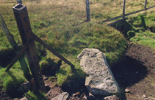 BJE10.jpg The stone is fallen down, the upper side has letter 'H'; note the old line of iron fencing is a little offset from the new fence. H for Harrison, the landowner in Longsleddale parish, to the south. The stone is lying so that, lifted, H is to the north, wrongly. (taken 7.9.2004) 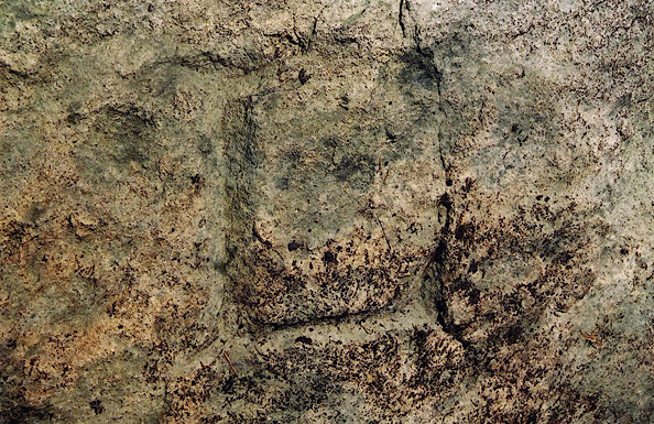 BJE11.jpg Boundary stone on Harter fell, between Longsleddale and Shap Rural, Westmorland, 7 September 2004. The stone is fallen down, the underside has letter 'L'. L for Lowther, landowner in Shap Rural parish to the north. (taken 7.9.2004) |
||
|
|
||
| evidence:- | map:- OS Six Inch (1956) |
|
| source data:- | Map series, various editions with the national grid, scale about
6 inches to 1 mile, published by the Ordnance Survey,
Southampton, Hampshire, scale 1 to 10560 from 1950s to 1960s,
then 1 to 10000 from 1960s to 2000s, superseded by print on
demand from digital data.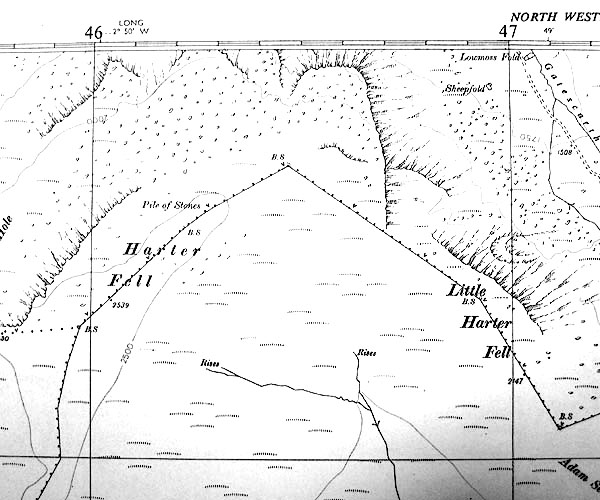 SINY4609.jpg "B.S." |
|
|
|
||
| :- |
The boundary stone is lying on the grass beside the fence where it turns. Letters:- |
|
| "L / H" |
||
| on opposite sides. L for Lowther, H for Harrison, landowners. |
||
| The boundary incidentally marks the parish boundary between Longsleddale and Shap. |
||
|
|
||
 Lakes Guides menu.