 Old Cumbria Gazetteer
 |
 |
|
| boundary stone, Longsleddale/Shap Rural | ||
| site name:- | Harter Fell | |
| locality:- | boundary, Longsleddale/Shap Rural | |
| civil parish:- | Longsleddale (formerly Westmorland) | |
| civil parish:- | Shap Rural (formerly Westmorland) | |
| county:- | Cumbria | |
| locality type:- | boundary stone | |
| locality type:- | parish boundary mark | |
| coordinates:- | NY45980931 | |
| 1Km square:- | NY4509 | |
| 10Km square:- | NY40 | |
|
|
||
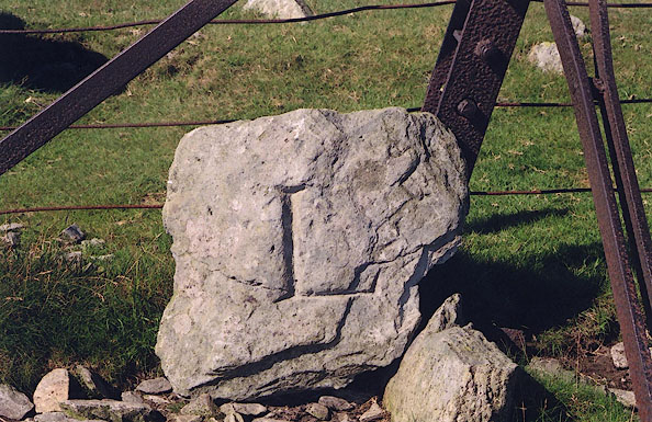 BJF01.jpg South face letter 'L' about 6 inches high. L for Lowther, landowner in Shap Rural parish to the north; the stone has been replaced the wrong way round. (taken 7.9.2004) |
||
|
|
||
| :- |
The boundary stone was found hidden on the cairn nearby; it has been replaced to lean
on the fence. Only the letter:- |
|
| "L" |
||
| remains on the broken piece. L for Lowther, not Longsleddale. |
||
| The boundary is a parish boundary between Longsleddale and Shap. |
||
|
|
||
 Lakes Guides menu.